- Cabinet Mountains
- Upper Cedar Lake
- Fork of Parmenter Creeks
- Minor Lake
- Many places on the divide as well as Taylor Peak, but these are all dry
- Fairly good. Some blowdown on all trails
- North Parmenter Creek and South Parmenter Creek are brushy with a fair bit of blowdown, particularly along South Parmenter
- Three Lakes Loop (Blacktail Lake, Moose Lake, Lake Estelle)
- Spar Peak
- Sky Lakes and Hanging Valley Loop
- Ross Creek Cedars Loop
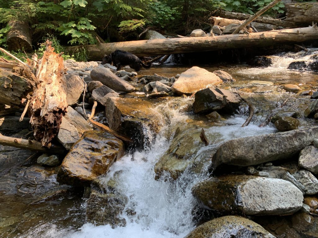
- Ross Creek Cascades
- Parmenter and Flower Creek Loop
- Little Spar Lake
- Leigh Lake
- Lake Estelle to Gem Lake Connector
- Lake Darling – Pend Oreille Divide Loop
- Horseshoe Pond
- Granite Lake
- Gem Lake
- Flower Point and Flower Lake
- Big Spar Lake
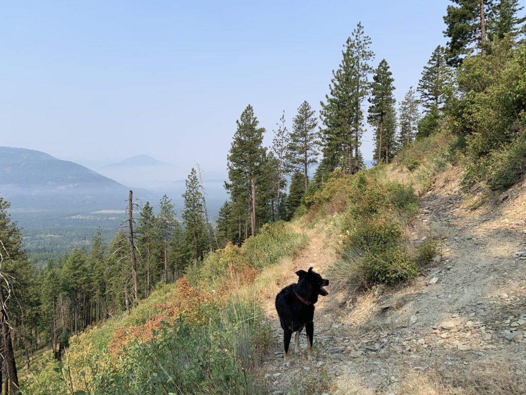
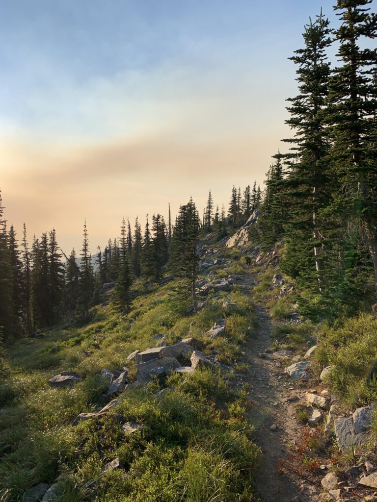
For the first two miles, the trail uses a wide forest road that sweepingly switchbacks uphill. A singletrack then breaks off to the right (signed) and continues gradually uphill. In fact, the entire 10-mile climb to the crest is so gradual that one barely notices going uphill. I suspect this is ideal mountain bike terrain (not allowed past the Wilderness boundary). Just shy of the four-mile mark is a seasonal brook, which late in July still carried plenty of water, which we used to fill up our bottles. If it is dry, you won’t find water until you reach Upper Cedar Lake. Past the brook, the trail continues to climb gradually, using old forest roads on and off. A bit past the five-mile mark, the trail diverts into the draw of aforementioned brook, approaching it repeatedly but never getting close enough to access water. That is, not until you reach the Wilderness boundary at the 7.5-mile mark. Twenty or so pace ahead of the sign, a game trail branches off to the right and the brook is relatively easy to access and also carried water late in July. This is the last source of water ahead of Upper Cedar Lake (if you do the loop clockwise) or Sugarloaf Pond (counterclockwise). The trail, so far in excellent condition, becomes a bit littered with blowdown as you enter the wilderness.
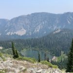
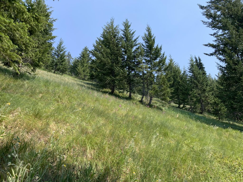
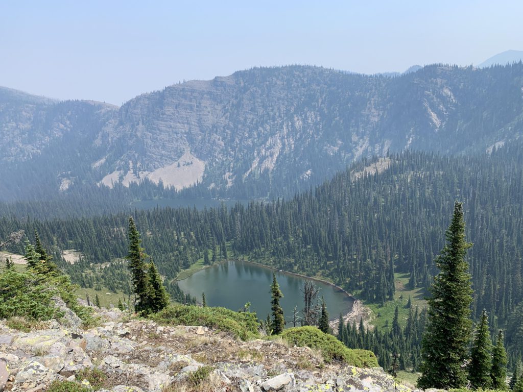
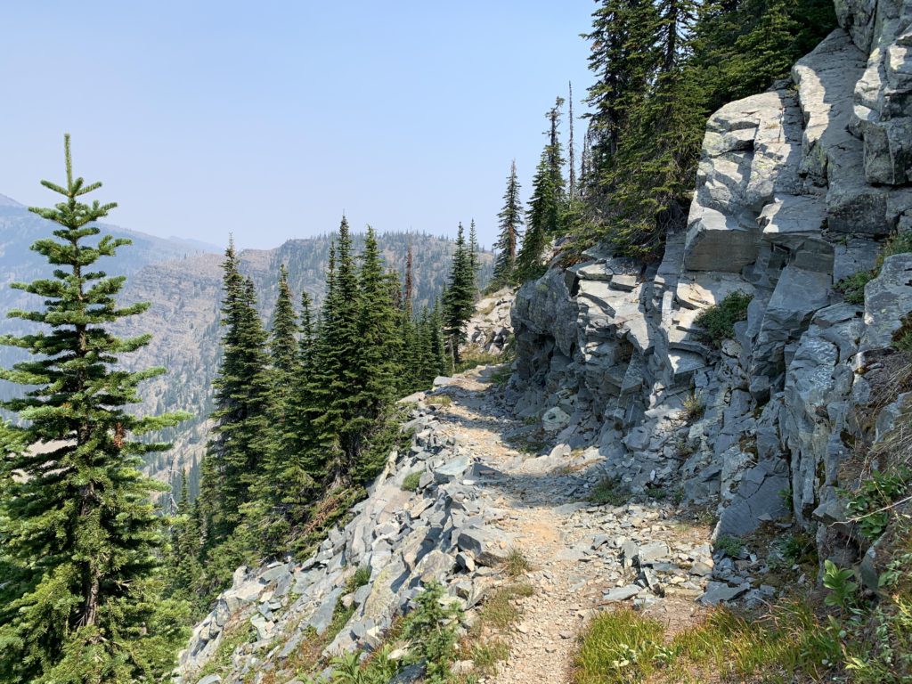
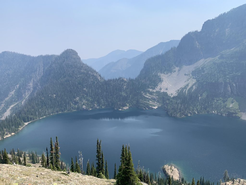
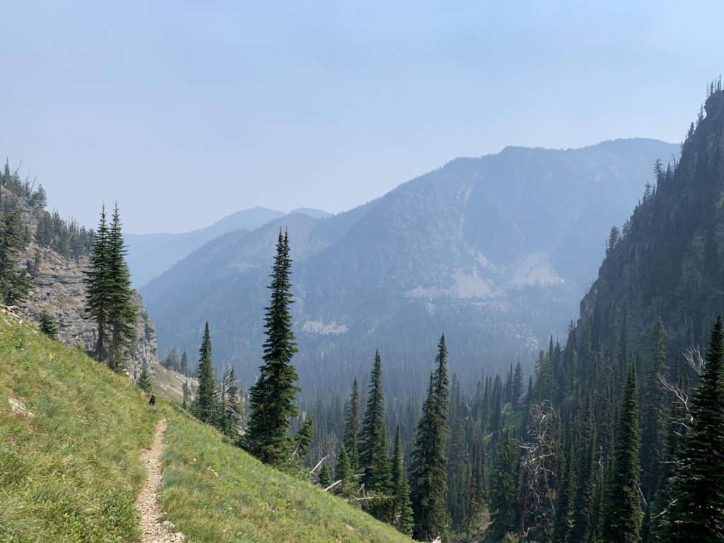
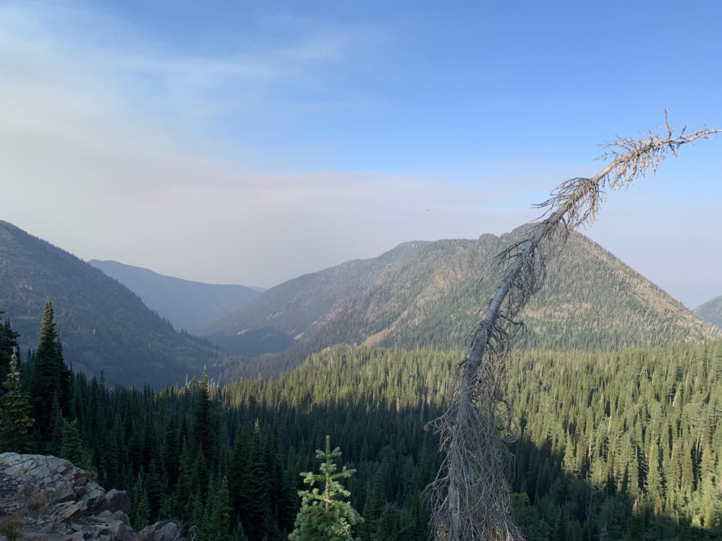
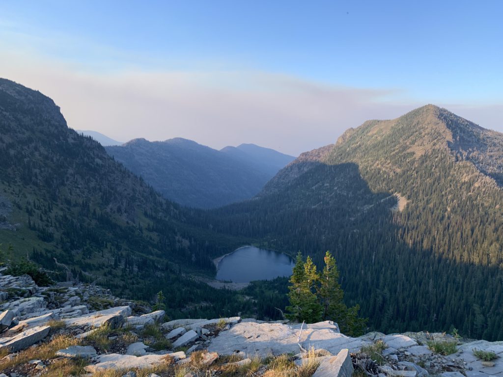
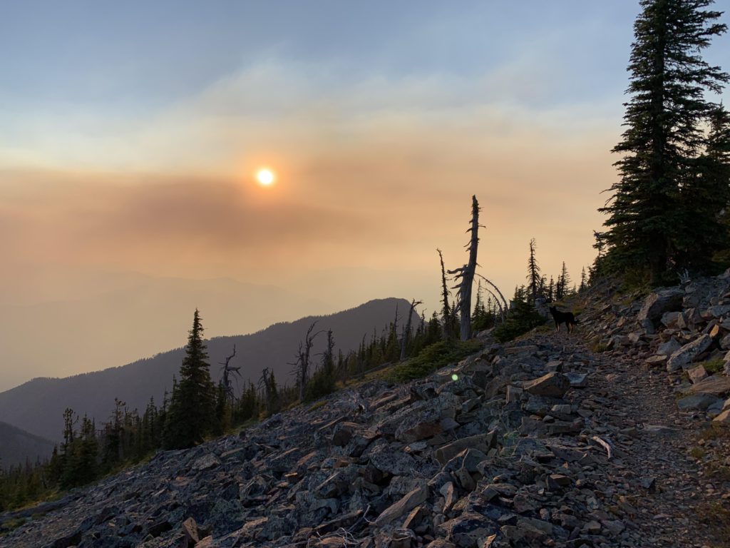
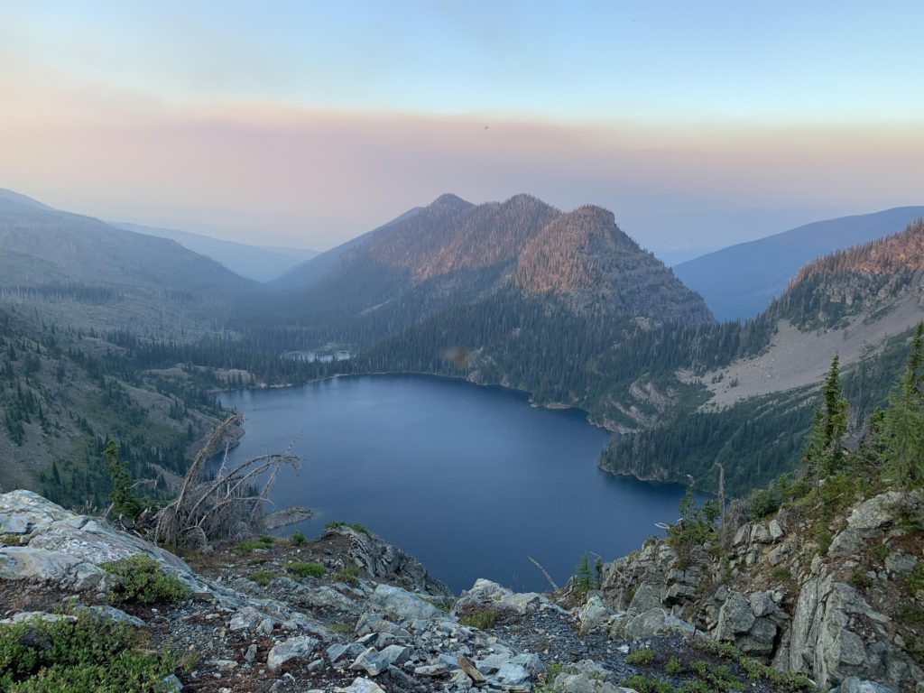
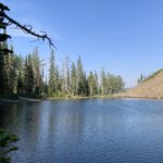
Continuously switchbacking uphill, the trail leaves the more or less dense forest behind and crosses a number of steep alpine meadows, then contours along Taylor Peak without actually reaching the top. The forest is quite open, so a quick climb to the top is easy; alas, there is little to see. Beyond Taylor Peak, the terrain levels off but still rises to a ridge overlooking Upper and Lower Fall Lakes near the 10-mile mark. Continuing south, you soon reach the junction with Divide Trail #360. Swing a left and contour along a small hump that stands between you and Cedar Lake, a section of trail that in part has been chipped out of rock as the cliff drops nearly vertically down to Lower Fall Lake. Nearing the 11-mile mark, Cedar Lake comes into view, and a fabulous view it is, including both the upper and lower lakes and the massive headwall that is Dome Mountain. On the opposite side you will note the gap that provides passage to the Parmenter Creek canyon.
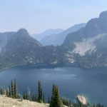
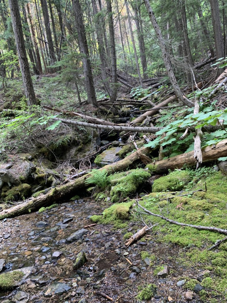
It’s about two miles down to the lake, and a 700-foot drop, which the trail alleviates by detouring to the ridge’s east face with great views up Grambauer and the devastation that a wildfire caused there years ago. Upper Cedar Lake offers several excellent (and exceedingly popular) campsites right on the lake’s shore. To continue, head south across the lake’s outlet, skipping the more well-trodded trail to the lower lake and Cedar Creek trailhead. Soon the trail starts to climb again towards Cedar Lakes Gap. Make sure to take the obvious 20-yard spur trail in a switchback that leads to a ledge with excellent views across Lower Cedar Lake. Then, continue to the Gap, which is about 200 vertical feet above Cedar Lake. Cedar Lake is obscured by trees, but the view down the North Pamenter Creek canyon is fantastic and if you peer carefully, you might even spot Lower Parmenter Lake to the right (the best place is at the first switchback). The trail drops quite steeply down a scree slope (watch your step!), then turns brushy, though mostly with delicious huckleberries. There is a fair bit of deadfall on this stretch down to Parmenter Fork, but most trees are de-limbed and easy to step over. The trail approaches North Parmenter Creek twice along the way and loses nearly 2000 feet of elevation.
At Parmenter Fork, swing a hard right (left heads to Parmenter Creek trailhead) and cross North Parmenter Creek, which was essentially dry in this location. Engage your trail finding skills as the trail becomes washed out and littered with deadfall as it moves along South Parmenter Creek. It is rather beautiful, however, with the lush, wet, rainforest-like red cedars and devil’s club in sharp contrast to the huckleberry-studded dry hillsides traversed earlier. Near the 15-mile mark the trail crosses to the Eastern side of South Parmenter Creek (a rock hop) and starts ascending the western flank of Indian Head. Trail conditions deteriorate somewhat as this trail is clearly less traveled. Expect frequent deadfall, washed-out tread and lots of shoulder-high brush. The trail crosses several tributaries as it climbs steadily, then crosses South Parmenter Creek again near the 17-mile mark (another rock hop). The forest opens up, the trail flattens out, and a series of beaver ponds replace the creek. The trail skirts these on the northern side, cutting through meadows and brush, which are perhaps the result of a long-ago wildfire or an avalanche.
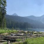
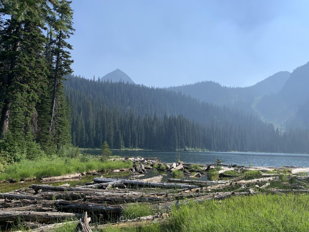
Minor Lake unfolds suddenly, hidden by a stand of trees that ring a large campsite near the lake’s outlet. Access for swimming is a bit tricky on account of the log jam, but doable. Naughty tried very hard to climb out of a water onto a log that just kept spinning. She did get out eventually. The water was cold but truly refreshing.
The continuation of the trail is marked “Weir Pass” and crosses the outlet at a wide spot, using several large logs. The climb to Weir Pass is uneventful, with most views blocked by trees and eyes shifting to huckleberries. Expect more deadfall and brush. At Weir Pass (~19 mile mark) the trail splits: Sky Lakes/Flower Creeks drops down to the southeast and the Divide Trail heads west, with the Minor Lake trail joining from the north. Continue on the Divide Trail, which is in good condition. A little side trip to Sugarloaf Pond is rather worthwhile, particularly if you are in need of water as there is no reliable source of water for the rest of the route. There is no trail to Sugarloaf Pond; the best route is to continue straight south at the second switchback, but gradually climbing westwards to skirt the massive rock outcrop that holds the pond in place. There is a campsite about halfway down the northern shore of the lake. From the lake’s westernmost end it is a relatively straightforward, albeit steep, climb through open forest in a northwesterly direction back to the Divide Trail.
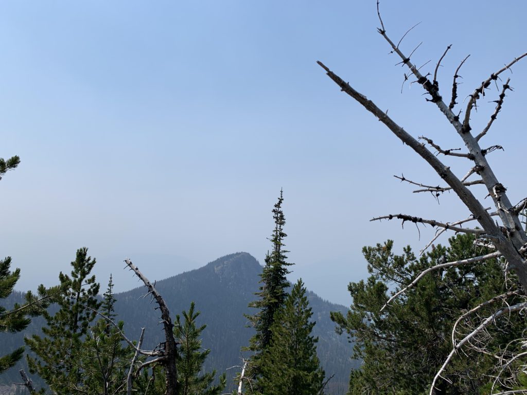
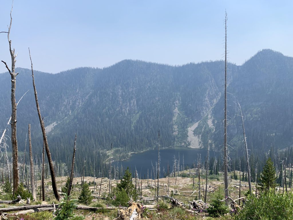
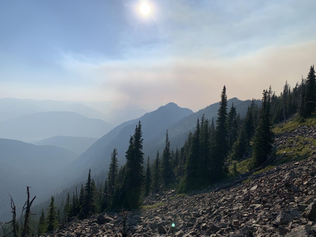
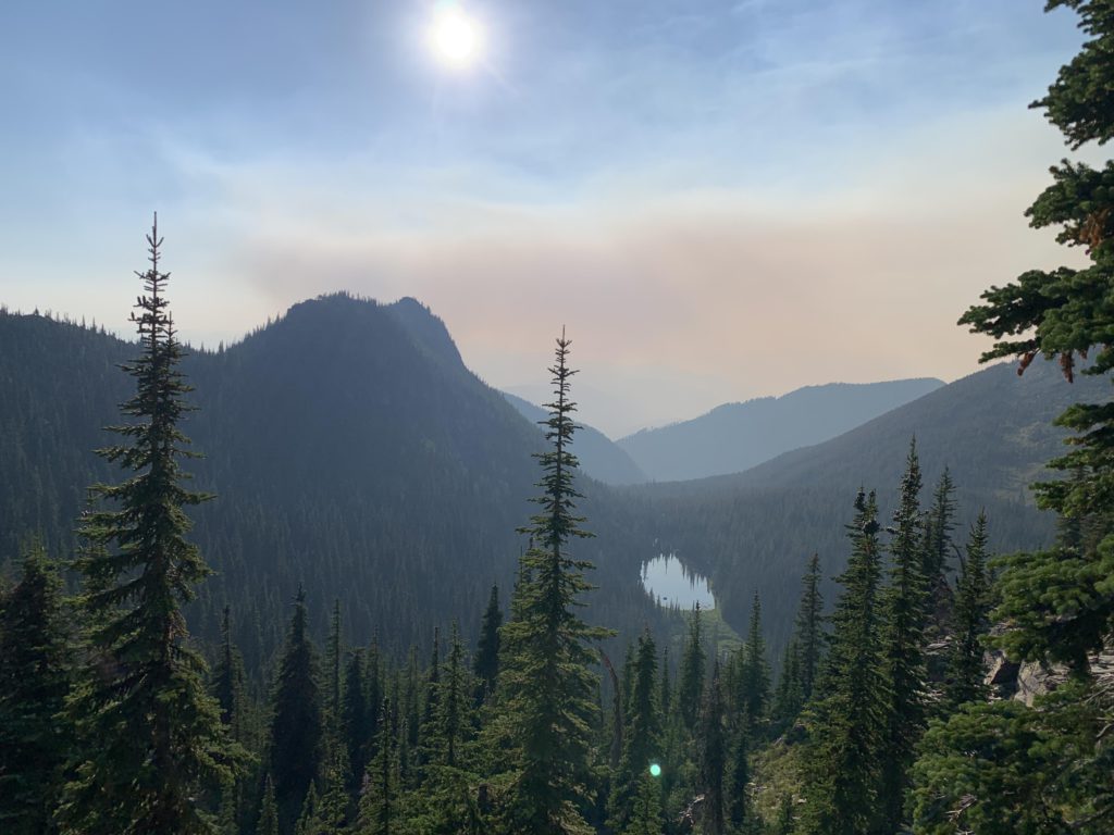
The next five mile are some of the best hiking in the Cabinets with views into the Bull Lake valley to the west as well as the string of alpine lakes to the east and far-reaching views into the Rockies. Looking back (south) you will have Sugarloaf Peak upfront and very distinctly far behind it Snowshoe Peak and A Peak. Make sure to look for Minor Lake, far below, at an opportune spot when the Divide trail hugs the eastern side. Once you round Dome Mountain you return to the junction with the Taylor Peak trail. At this point it’s another 10 miles downhill and it was getting late. We made it back to the car just after midnight.
Alternate Routes
- Similar to the Parmenter and Flower Creek loop, this loop connects to numerous other trails, including routes to Grambauer, Cedar Creek, Parmenter Creek, and Flower Creek/Sky Lakes
- Consider a short, steep ascent across talus to Dome Mountain
Things to Consider
Not so great