- Channeled Scablands
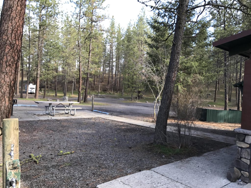
- There are designated campgrounds in the park (Nine Mile, Bowl & Pitcher, Equestrian)
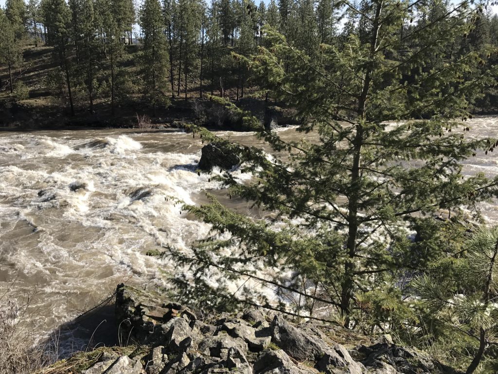
- Excellent, but flooded in many places. Trail is generally well signed.
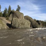
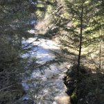
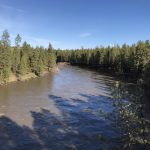
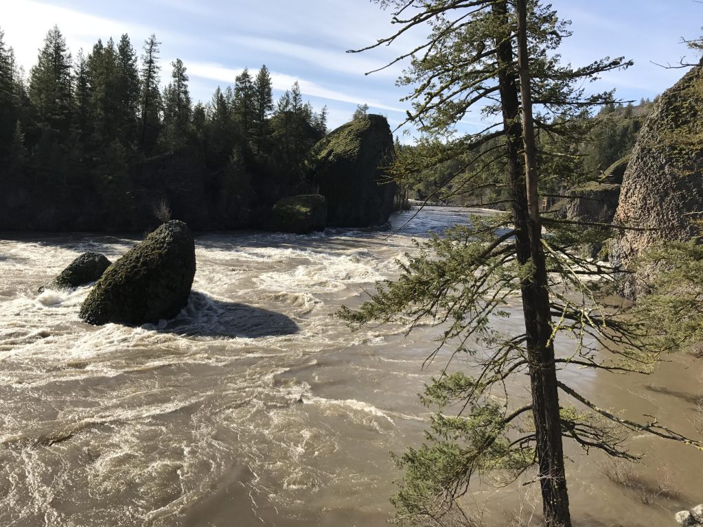
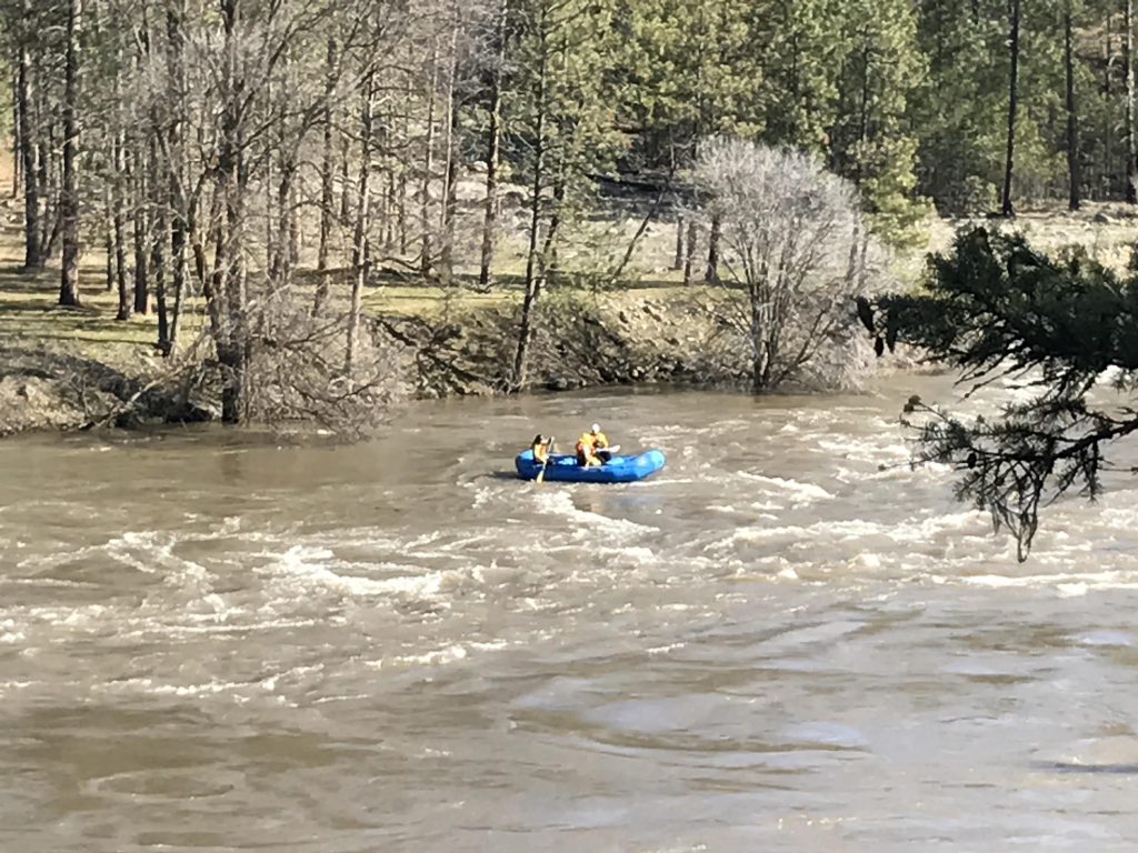
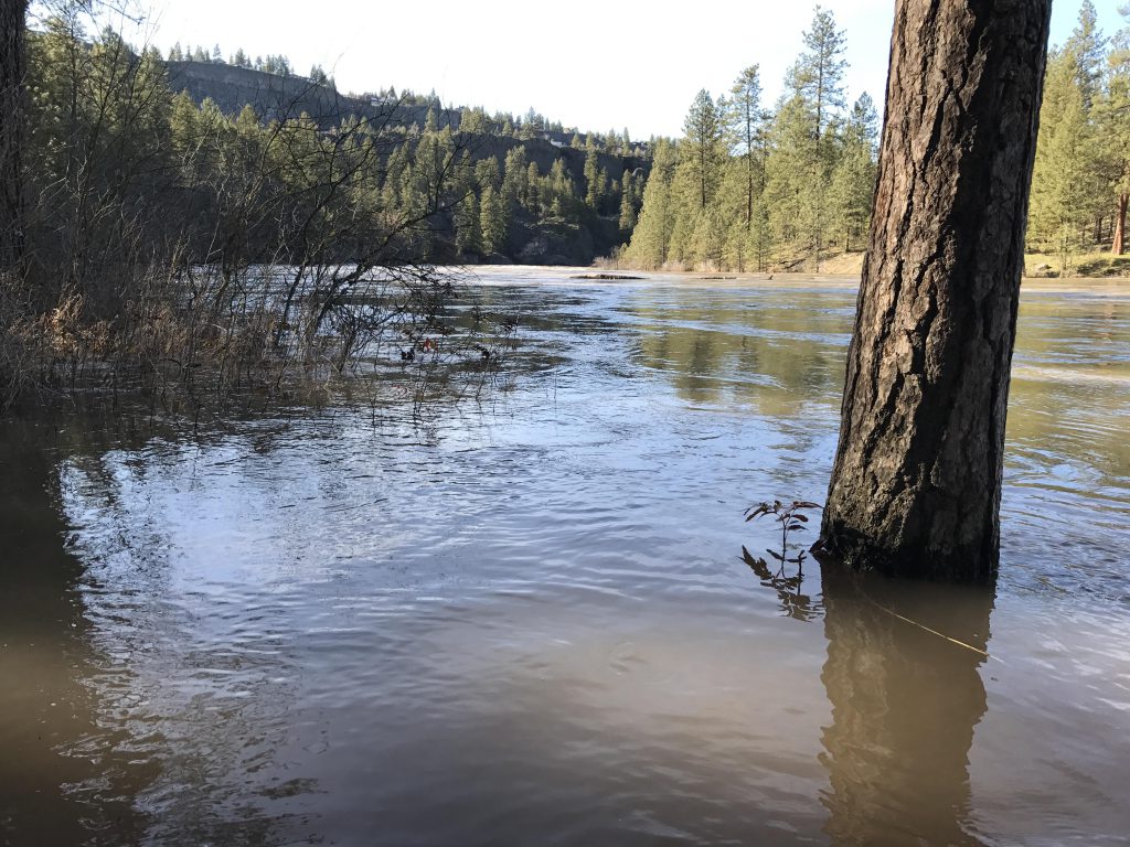
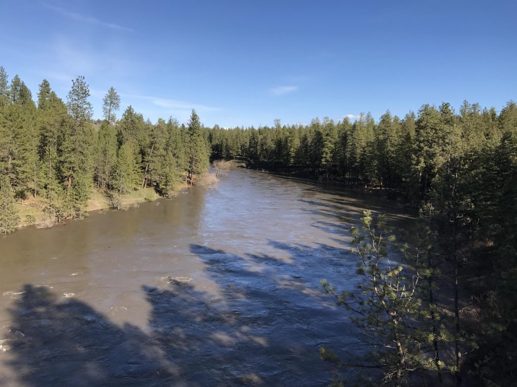
Trail #25 starts out on the far side of the suspension bridge spanning the Spokane River. There are excellent opportunities to take pictures of the river and the pitcher-and-bowl rock formations as you cross the river. Due to heavy snow and rainfall this year, the water level in the river was particularly high.
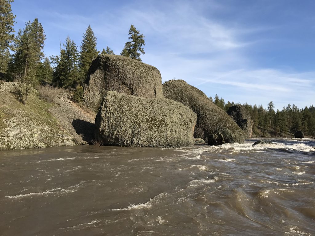
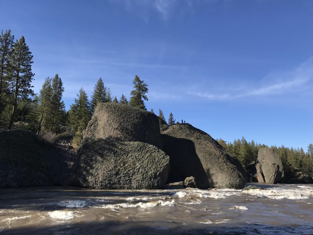
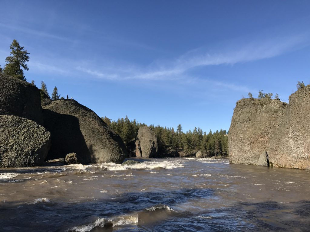
On the west side of the river, head north along a wide single-track paralleling the river. The trail at first veers away from the river and intersects with an even wider double-track. Turn right at this point, back towards the river, and get ready for a view of the Devil’s Toenails, large boulders poking out of the riverbed.
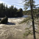
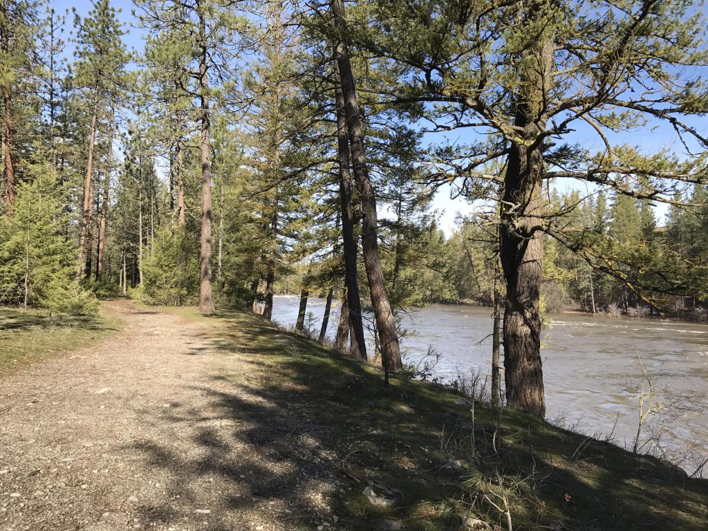
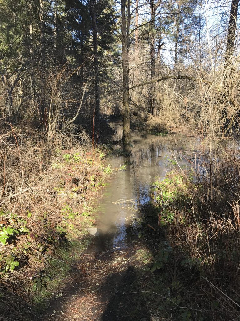
Shortly after a mile, the trail drops down to the riverbed and due to the high water level was completely swallowed by the river. Thus, we detoured uphill and reached a blacktopped road (Centennial Trail), which we followed for approximately half a mile to a point where it rejoined the original single-track. The gravel single-track then stays above the river for some time, but eventually drops back down to the water level. In short order we faced a seriously flooded trail. We bushwhacked across the hillside for perhaps a hundred yards and found the trail on higher ground, but only for a minuscule distance. Past the three-mile mark we came upon a trail that climbed the hillside, and since the riverfront trail was heavily flooded, gave up and headed for higher ground. The trail (#10) led to the Centennial Trail (it dissects the entire park), which we crossed and then turned right (north) onto trail #212.
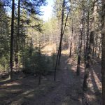
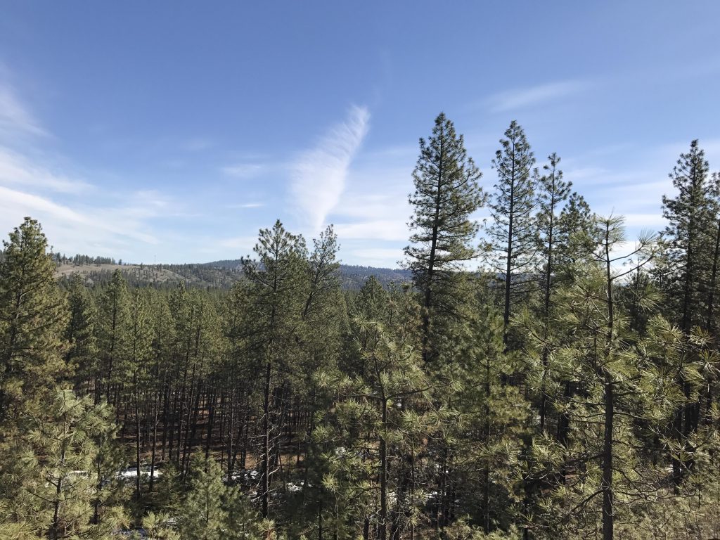
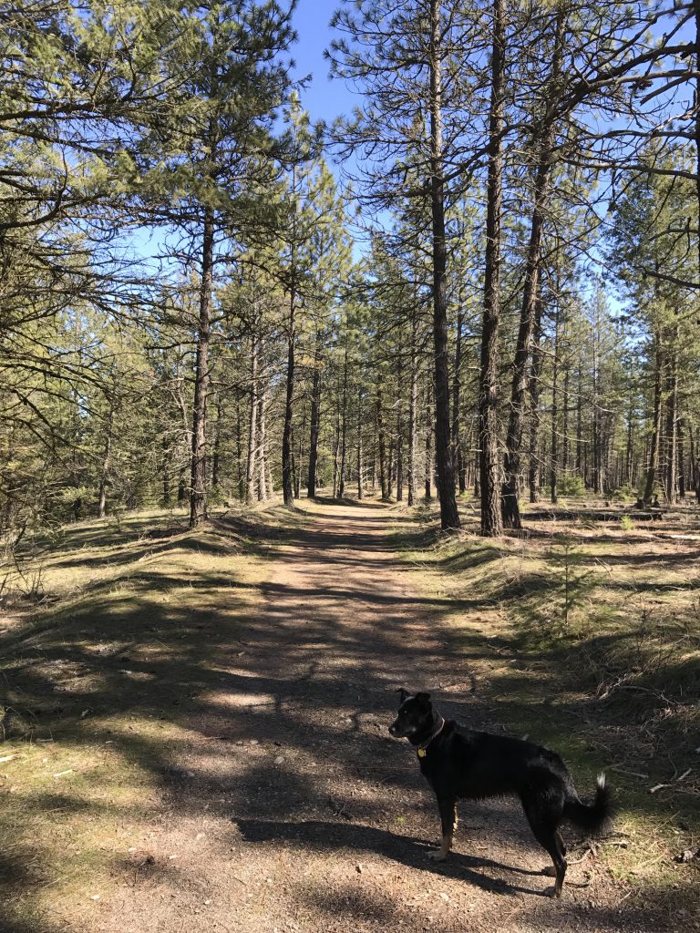
Trail #212 is a broad double-track that’s easy to follow as it winds through thin forest, away from the river. It heads generally in a northwesterly direction, but eventually curls around and heads east to meet up with trail #25 around the four-mile mark. Trail #25 is also a wide double-track at that point, and continues through a lightly forested area, along the base of a knoll. The forest soon gives way to broad meadows, and the trail moves sharply right (W Missoula Street), then diagonally crosses an open area towards several residences. The trail then parallels North Riverside Park Drive to the intersection with West Seven Mile Road. Continue on, going north on W 7-Mile Road for a bit, then cross the road and you’ll find the single-track once again on the other side.
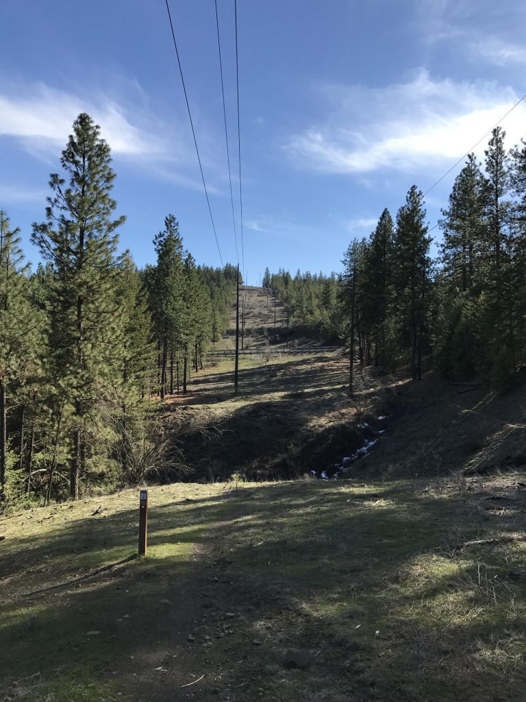
The trail quickly veers away from the road and heads into the woods, but never strays too far from the road. After climbing a small hillock, the trail re-approaches the road and moves across a swath of meadow (where the power lines cross). The road then climbs the side of the hill, while the single-track stays low for a bit longer and reenters the forest. At the six-mile mark, the trail heads uphill in earnest, reaching the ridge quickly (it’s only around 100 feet of elevation gain). The trail moves past a residence, then crosses a flat, open area and an old roadbed and approaches the edge of Deep Creek Canyon.
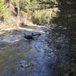
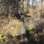
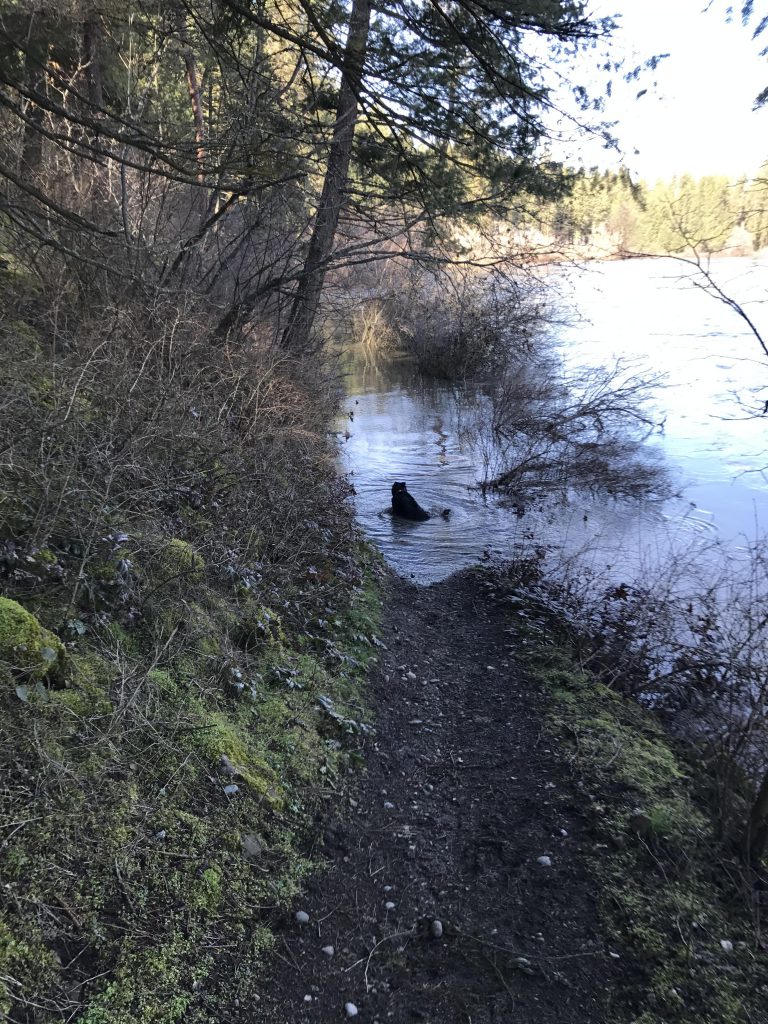
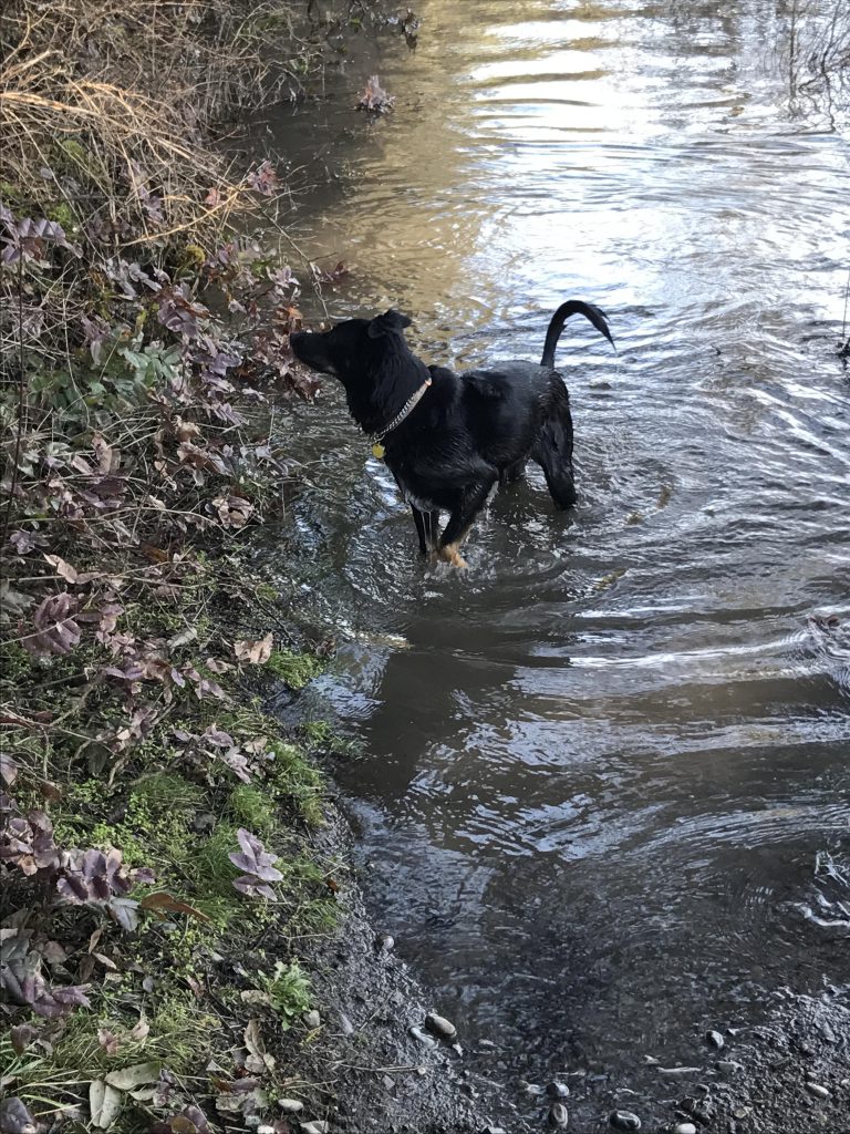
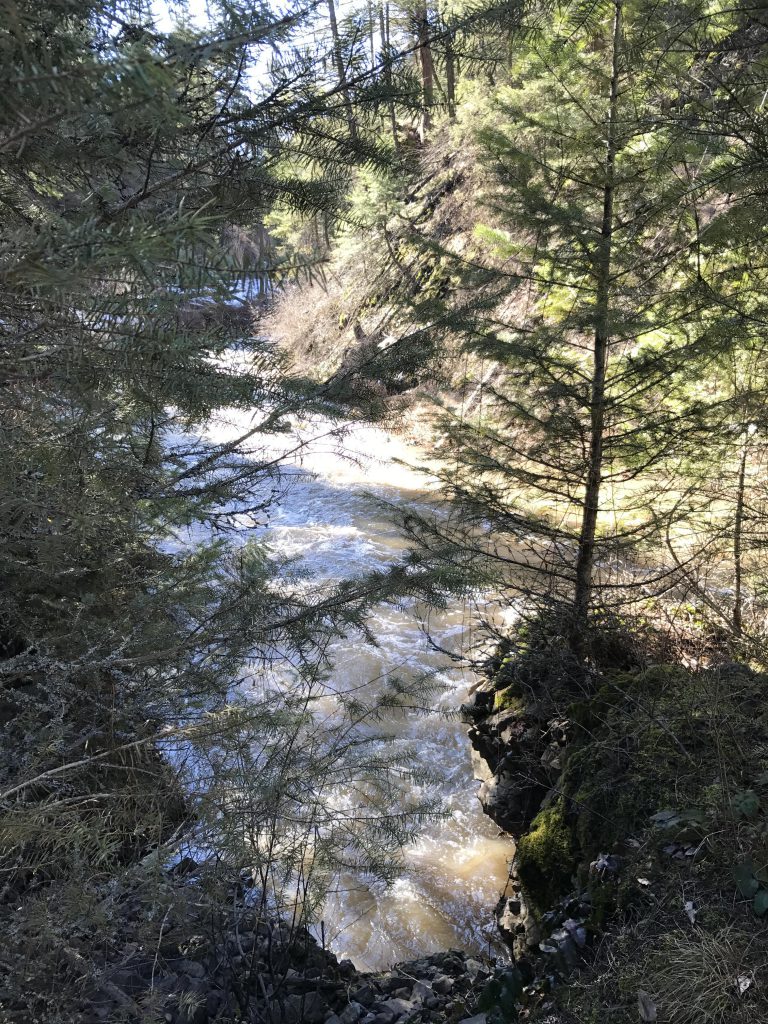
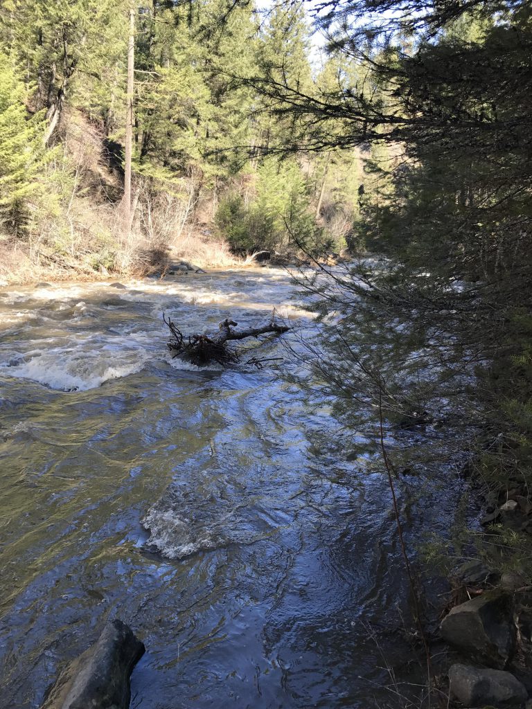
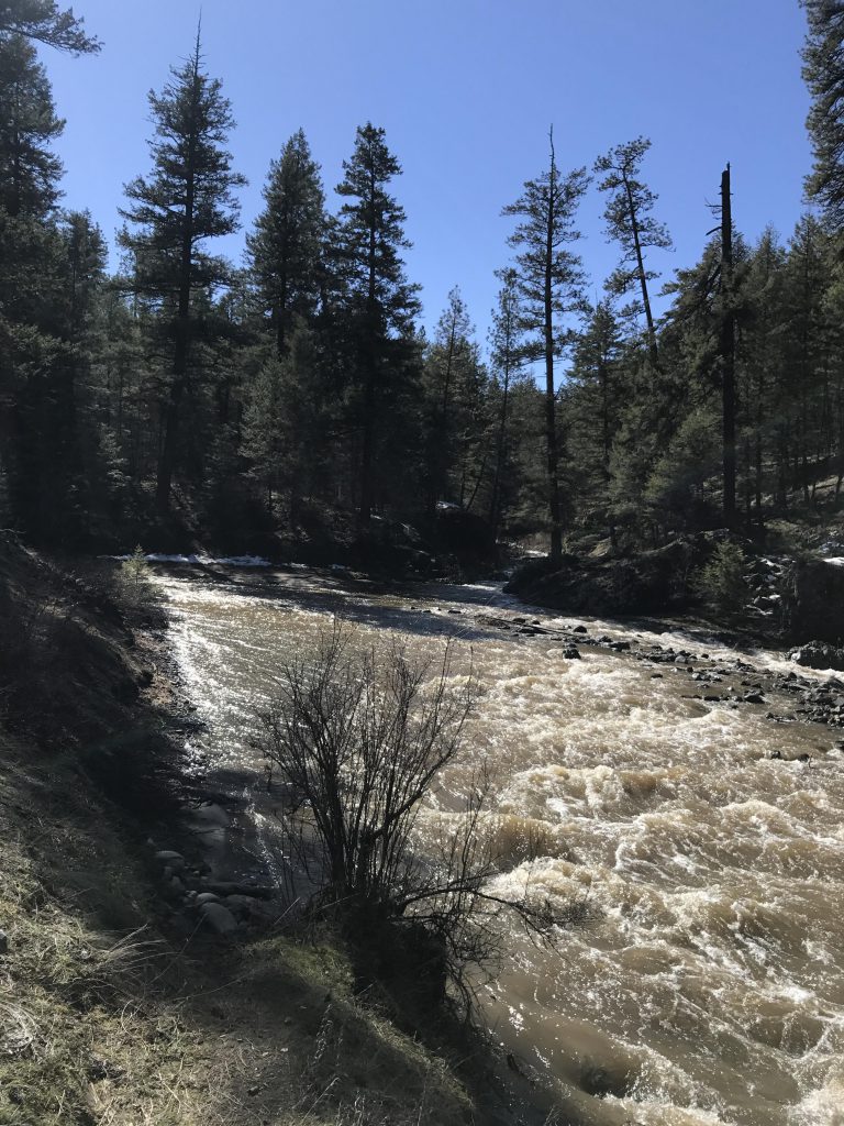
The single-track switchbacks down to the water, which, lacking a bridge, must be forded. This turned into a major obstacle. The creek was swollen and torrid and brownish with dirt and sand. Naughty, upon sliding into the creek, immediately got swept away and had to be scooped out by the scruff! We tried our luck at a more promising spot further downstream, where a large boulder, situated almost in the middle of the creek, resisted the torrent. With the assistance of a stick, the Scribe made it to the rock, wading through hip-deep water that pulled and tugged, but Naughty didn’t like the undertaking. Since the deepest and fastest-moving section still lay ahead, we threw in the towel and paused in the meadow above the canyon to dry off.
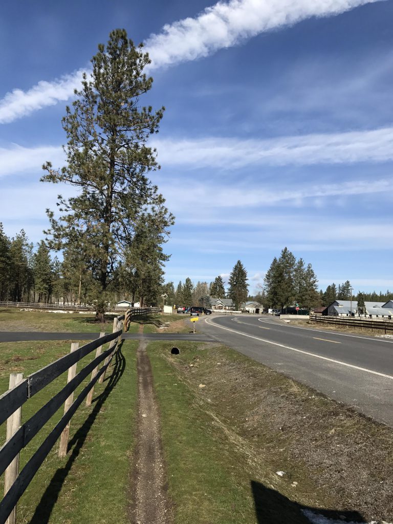
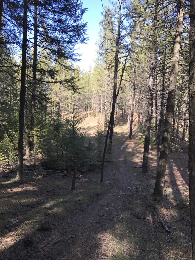
Skipping the Deep Creek side of the trail, we chose the old roadbed that led south to the Deep Creek Overlook trailhead, where we took a right and once again approached Deep Creek. This is a nice single-track that meanders along the creek without crossing it. The creek is S-shaped in this location, and as you get into the upper part of the “S” the trail ascends and reaches the access road above (North State Park Drive). Continue along this road to several houses and the intersection with West Seven Mile Road. Cross 7-mile and head south on North Inland Road (you’ll have to go west for a short section to get onto this road). Trail #25 will pop up on your left (and on your right, which is the return from the Deep Creek/Pine Bluff section).
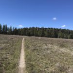
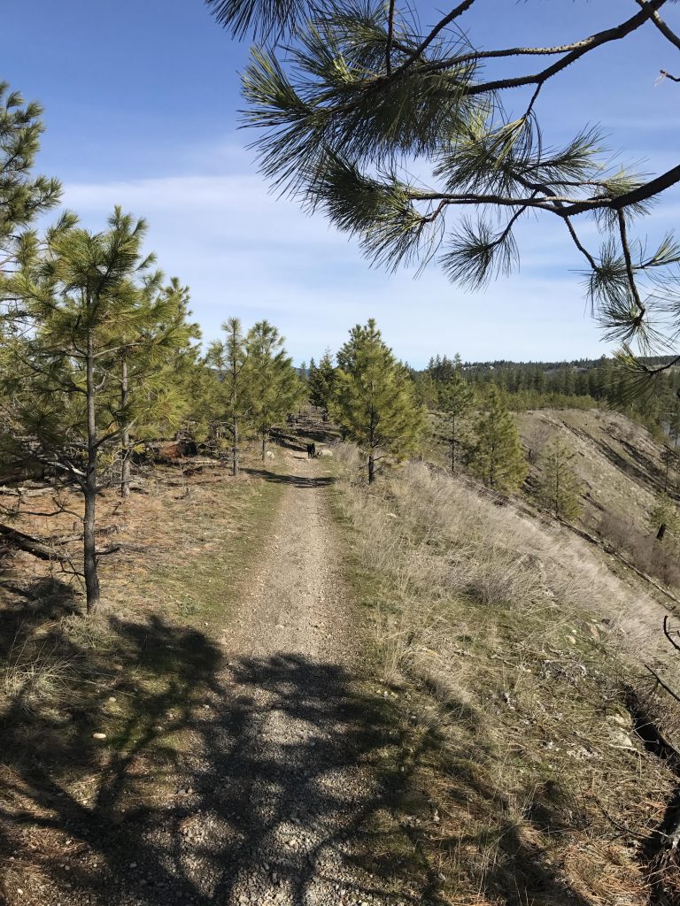
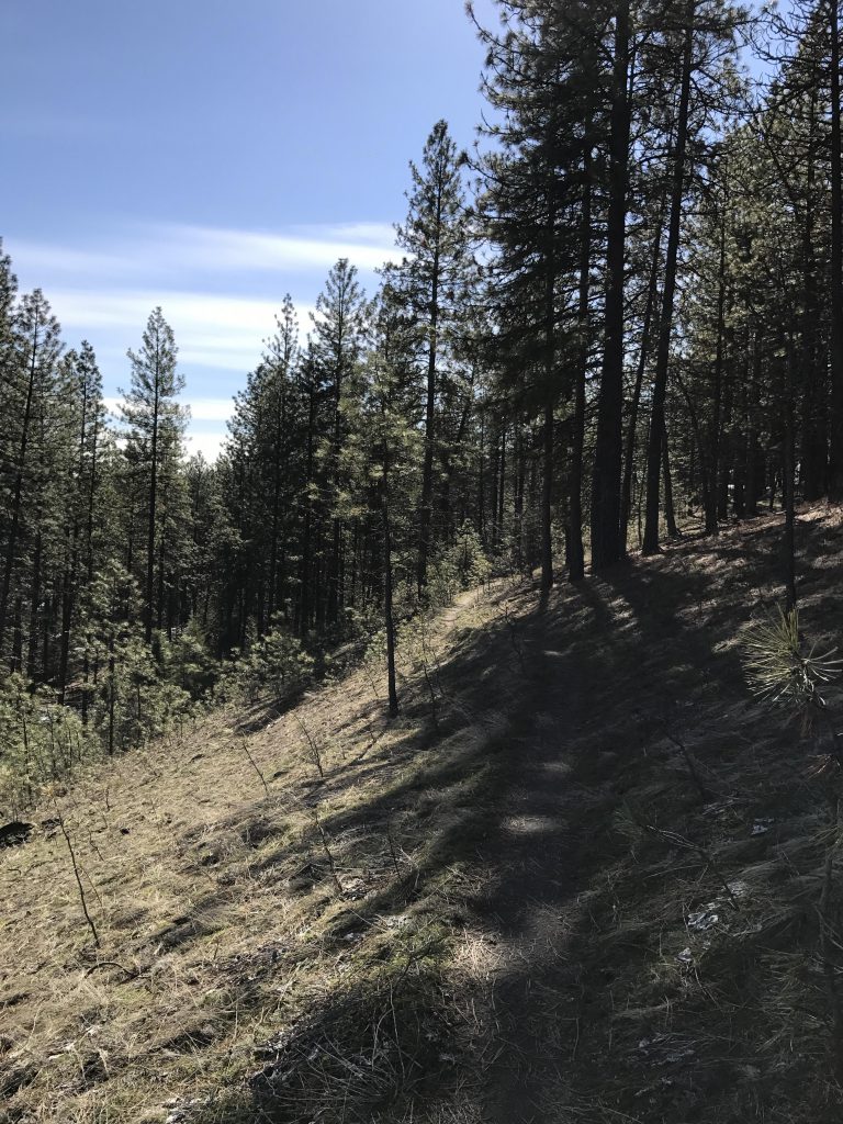
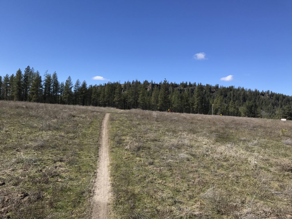
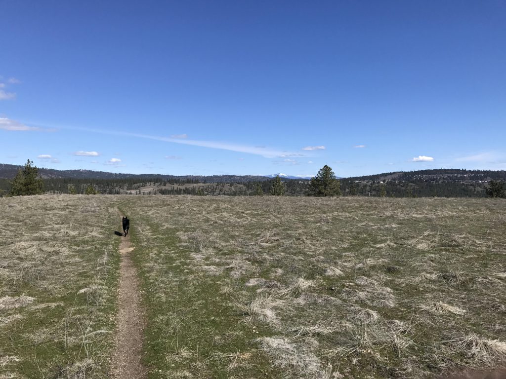
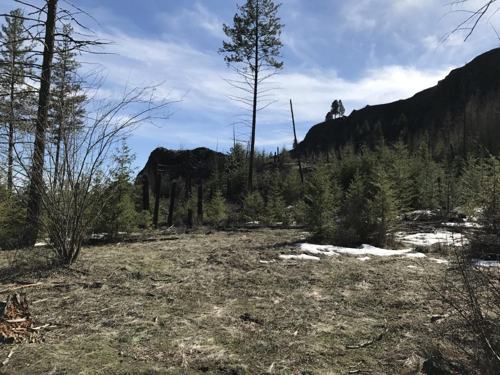
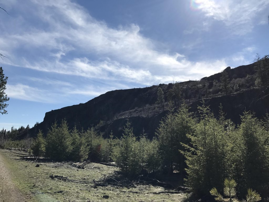
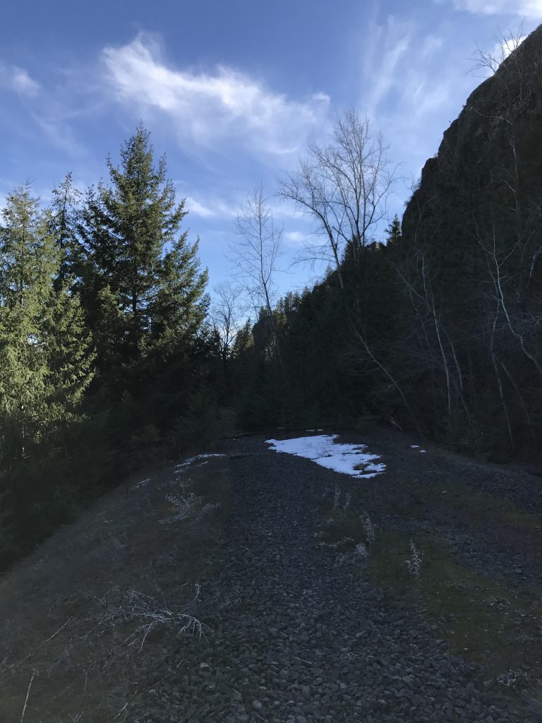
The trail is a straightforward single-track, tracing the edge of the meadows on the high bluffs and offering pretty views, including occasional glances at Mount Spokane in the distance. The only downside in this section is the noisy proximity of the ORV lot to the west. Once past the ORV lot, the trail reenters the woods and soon declines. It heads generally southeast, but then turns south and approaches the tall basalt cliffs this area is known for, at times making use of old fire roads, and at one point even rising up to an old railroad bed.
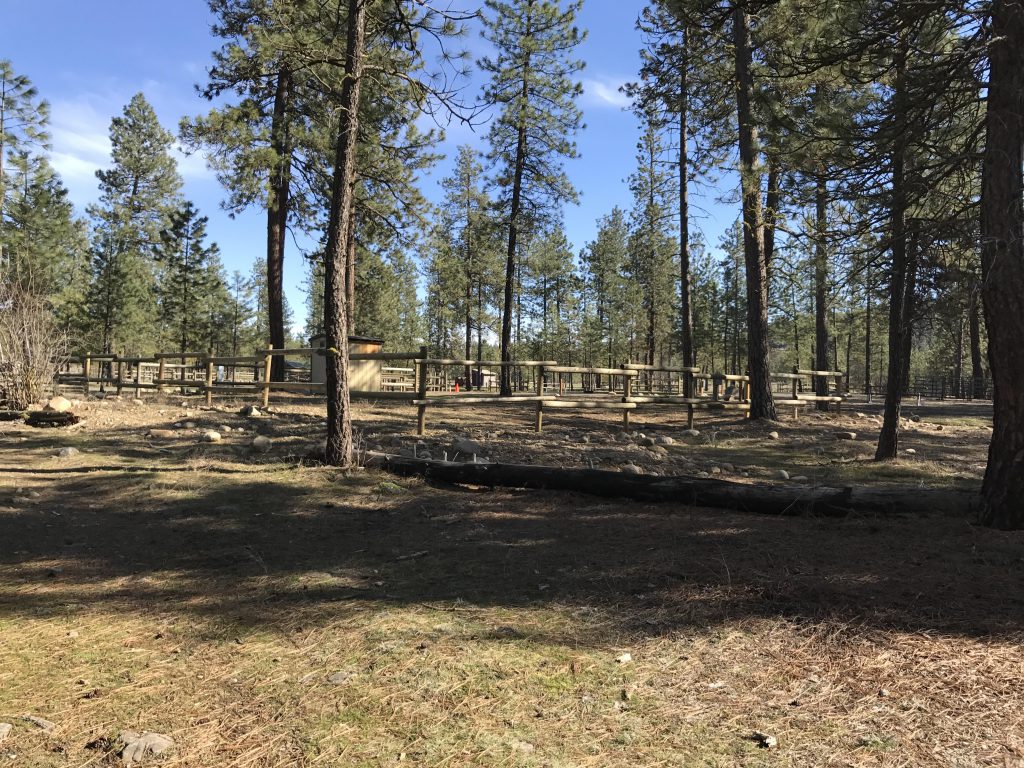
To complete the loop, stay north of Equestrian Lane (a paved road) and follow the power lines almost all the way to West Trails Road. Shortly before that, though, the trail angles sharply left, crosses Equestrian Lane, and moves into the equestrian portion of the park. This sections consists of forest and later open meadows and features corrals and campsites.
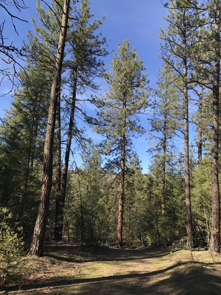
After traversing the equestrian section, the trail re-approaches the Spokane River, where you’ll take a left and follow a wide single-track back to the suspension bridge. Due to its proximity to the Bowl and Pitcher area, this trail gets a lot more foot traffic. Rightly so, as it offers splendid views of many interesting rock formations, gets really up-close to the river, and traverses many small scree fields.
Alternate Routes
- There is a maze of trails and old roads in the park and the park service does not have a good hiking map for download. However, most trails are shown and labeled on the USFS Visitor map and the OpenHikingMap. Plus, while many trails are unmarked, Trail 25 is very well signed
Things to Consider
Not so great


That looks like a sweet hike. Those rock formations are awesome!
Definitely a nice park. We’ll be back this summer when the water level is lower to finish the loop