- Bitterroot Mountains
- Shortly after passing Timber Creek (excellent)
- In the flats after crossing Halm Creek
- At the confluence of Ruby Creek
- Shortly before Bacon Creek (excellent–we stayed there the first night)
- At first fording of the St. Joe
- Bacon Lake (excellent–we stayed there the second night)
- At Tinear Creek crossing
- At Mule Camp (excellent)
- After the second fording of the St. Joe
- Broken Leg Creek (3 sites, the first in the elbow of the river, the second a large one right on the river (excellent), the third an outfitter’s camp after crossing the creek–we stayed there the third night)
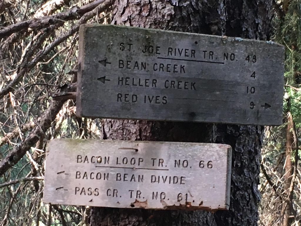
- The St. Joe River Trail (#48) was well maintained
- There were a fair number of fallen logs on the Bacon-Bean portion (#66), especially the ridge towards Bacon Peak and along Tinear Creek.
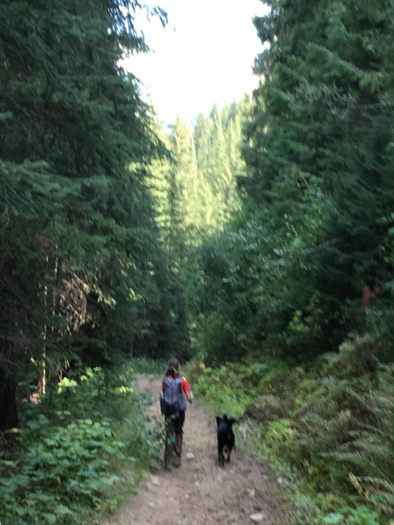
I was nearly bushed when we started out on this trek, having completed the 45-mile Lost-Creek-Trout-Creek loop two days prior, but I’m always up for a little hike and so off we went, the entire pack this time. That included the Scribe (limping far behind on account of his blistered feet), the Lady (taking the lead), the Big Pup (dressed me in my harness and made me pull her) and the Little Pup (in back, keeping the Scribe company).
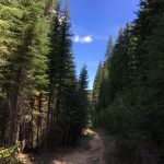
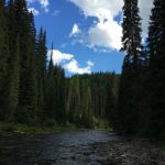
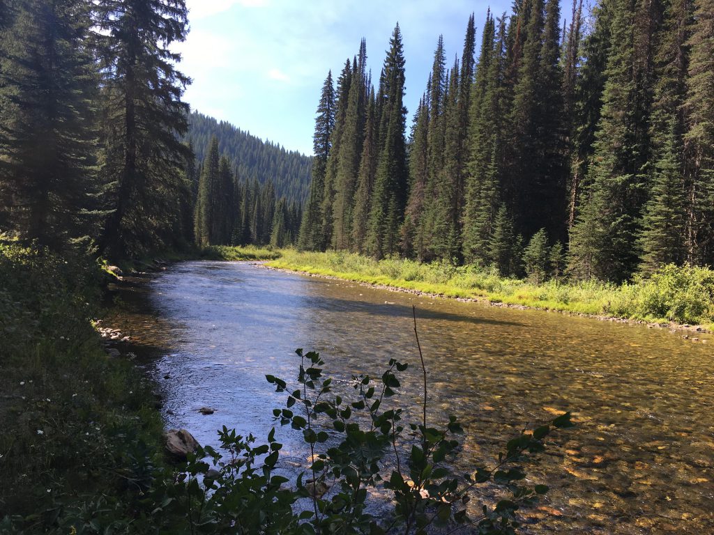
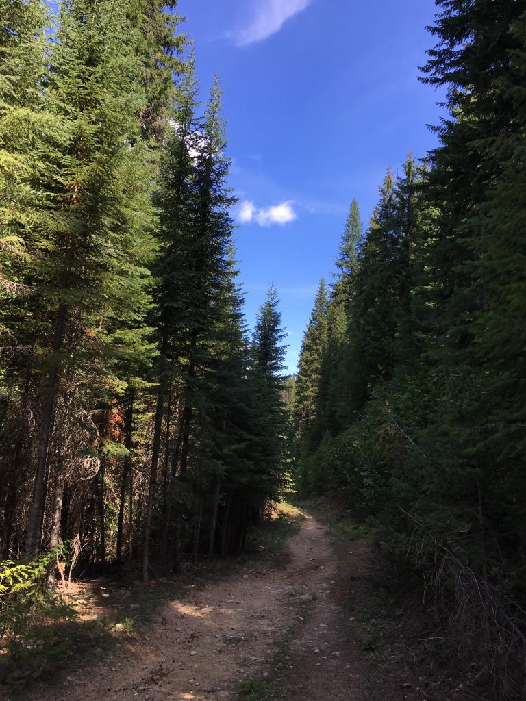
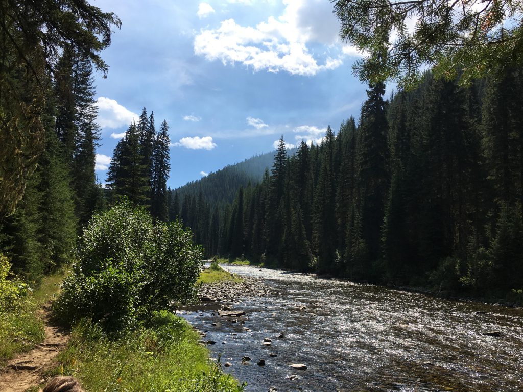
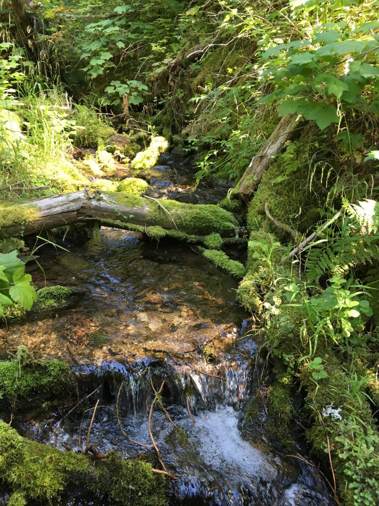
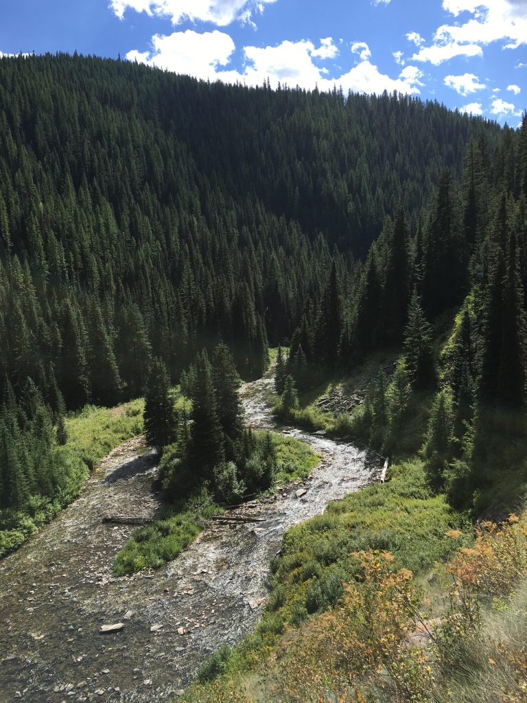
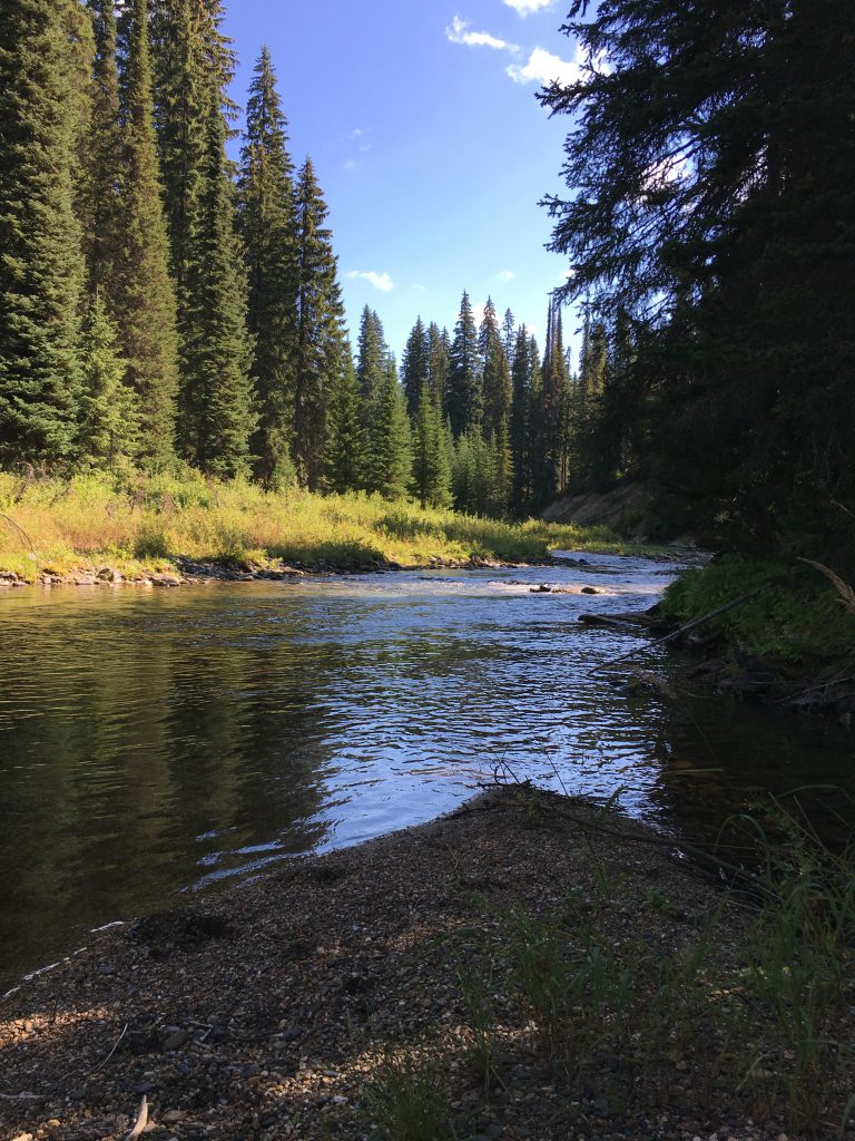
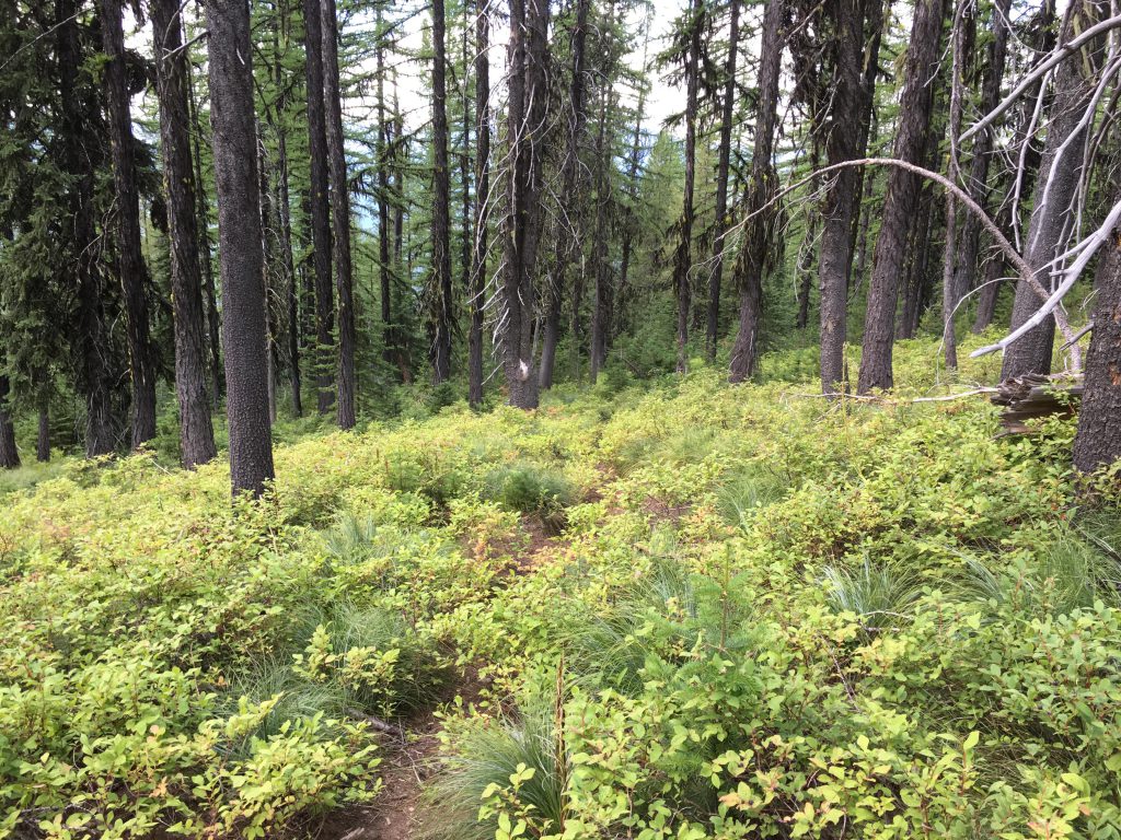
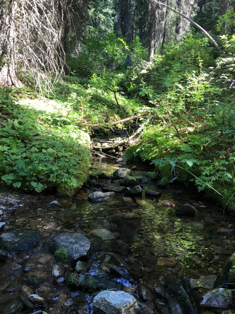
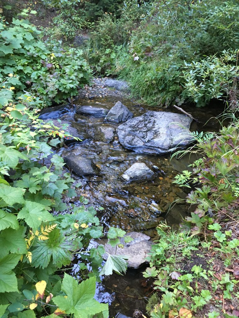
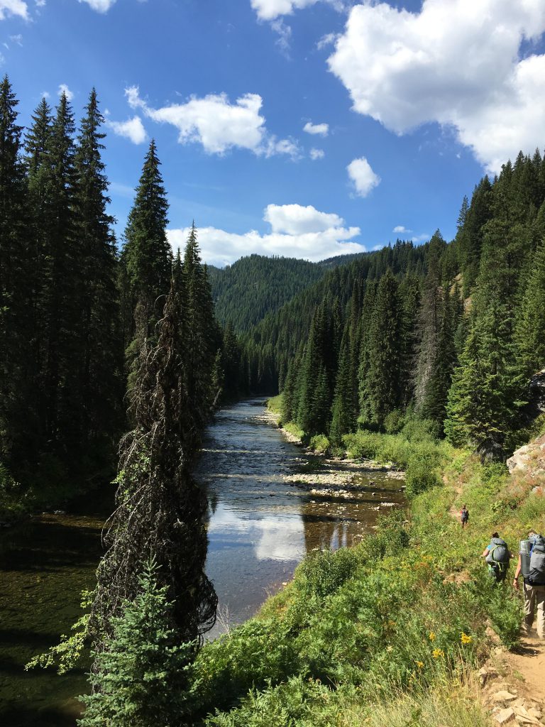
We reached Spruce Tree Campground shortly before noon on a beautiful summer day, after a grueling three-hour drive, and I immediately ceased the opportunity for a quick dip in the St. Joe River. The first few miles of the trail consisted of a decommissioned forest road, which by the smell of it (and the look of it, for you olfactory-impaired readers) experienced some serious equestrian traffic. The soil was all dug up and sandy and felt gritty on my paws. The terrain rose slightly until we were about a hundred yards above the river. Mature lodgepole pine stood tall on both sides and filtered the view of the river below. The trail followed the river closely, crossing a few tributaries, which at this time of the year were easily traversed. Nonetheless, the Scribe managed to get his feet wet and then put on his sandals (he always gets the order wrong!). About three miles into the hike we hit on the fork to Timber Creek, on the right, which we did not take. There is a campsite right there at the fork, but a much better one adjacent to the riverbank followed a hundred or so yards later. We kept on going, the trail closing in and getting away from the river again and again, rising up on the mountainside only to ease back down. A number of small moss-covered tributaries were easily navigated, some even featuring convenient wooden bridges, which I of course bypassed. On a number of occasions trails branched off to the right; those are equestrian paths that crisscross the river and lead to an equestrian lodge down by the river. Bear left!
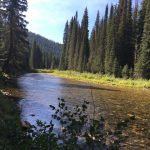
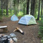
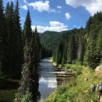
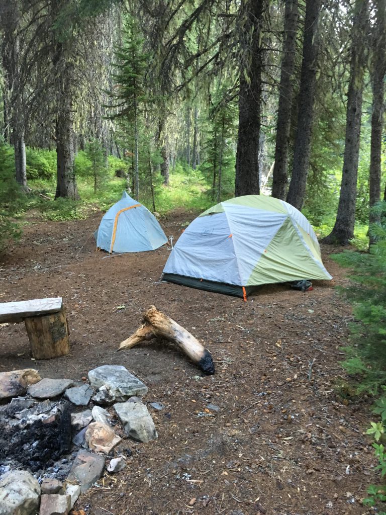
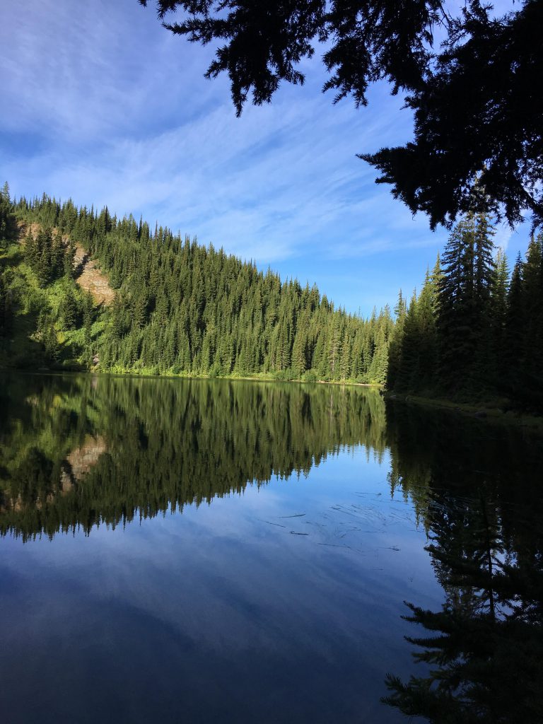
At around the six-mile mark the trail dropped down to the St. Joe near the confluence of Ruby Creek. There was a sizable campsite here, already claimed by trail maintenance folks. I announced our presence with a few wuffs, and then we kept going, following the sharp left in the course of the river. The trail stayed close to the water, which brought delight to everyone–me, for quick cool-down dips, the Scribe, for taking pictures left-right-up-and-down, the pups, for wading in as far as they could without getting their feet wet. Another two miles brought us to our first campsite, sitting next to the river, complete with two benches.
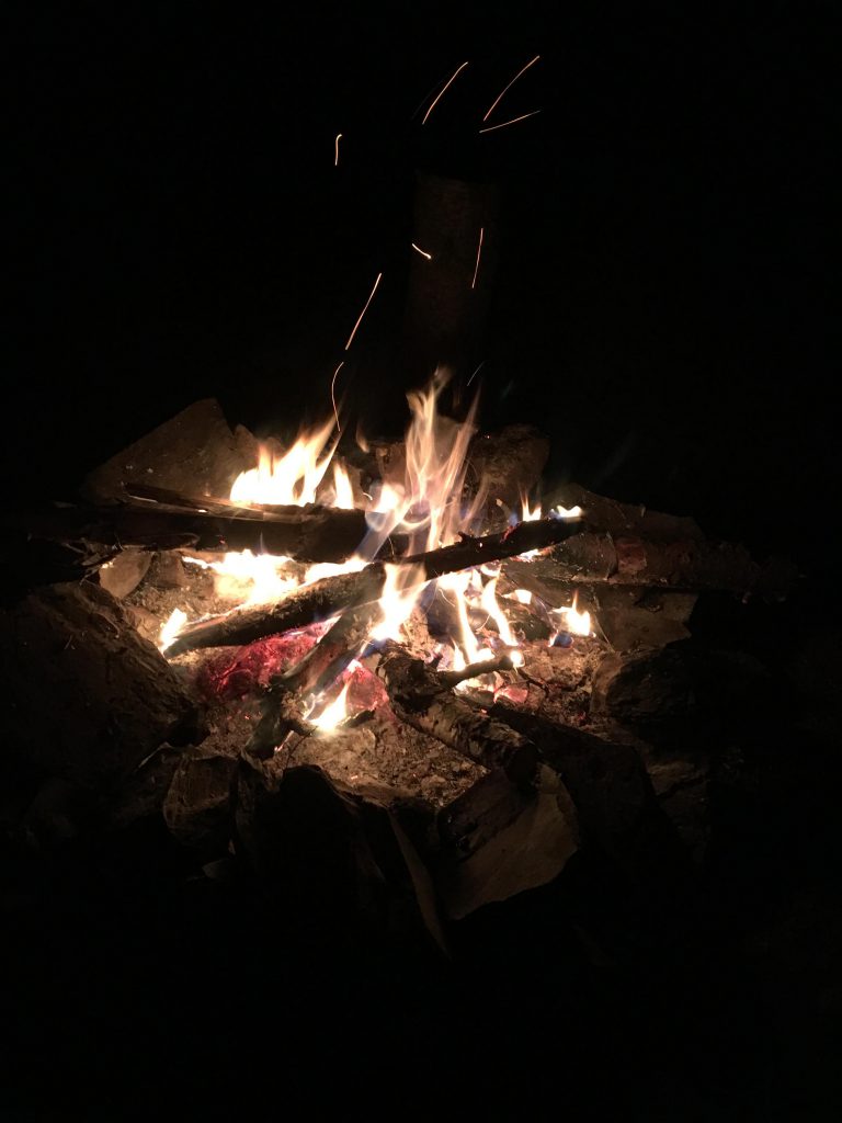
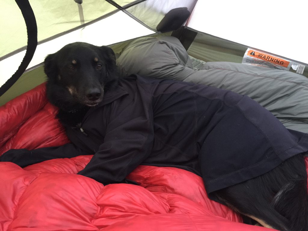
The Lady was delighted over the benches and was I, too, since the place reeked of squirrel. In short order I took off in their pursuit, while the rest of the pack commenced with camp duties. Big Pup fetched and filtered water, the Lady got the kitchen going, Little Pup gathered firewood, and the Scribe put up the tents. Soon we were eating dinner and with disdain I realized that my usual salmon kibble had been replaced with some kind of lightweight mush that tasted of nothing much at all. I snarfed it down anyway. Then it got dark quickly and with it the temperature plunged. The kitchen was cleaned up and the Scribe built a campfire, next to which I found a cozy spot and curled up. Oh, the good times!
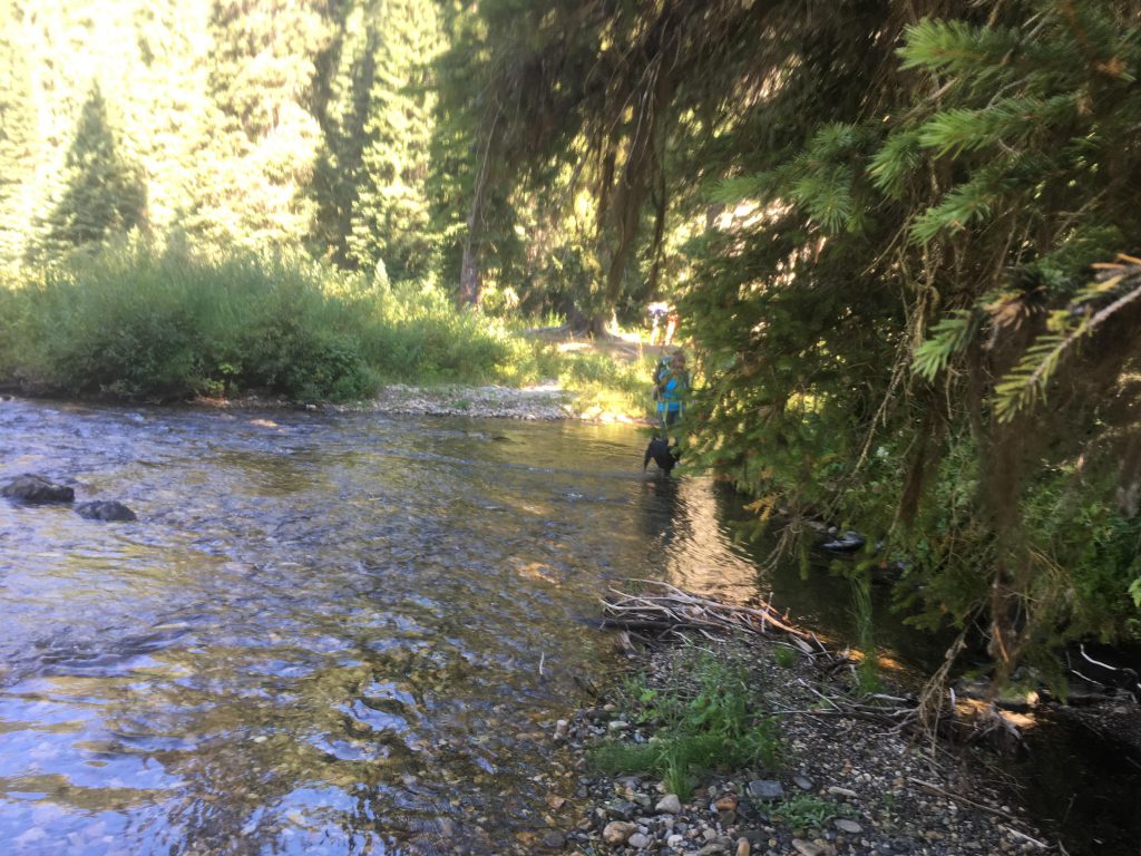
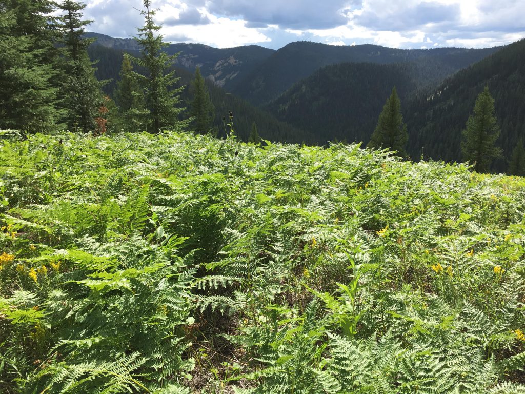
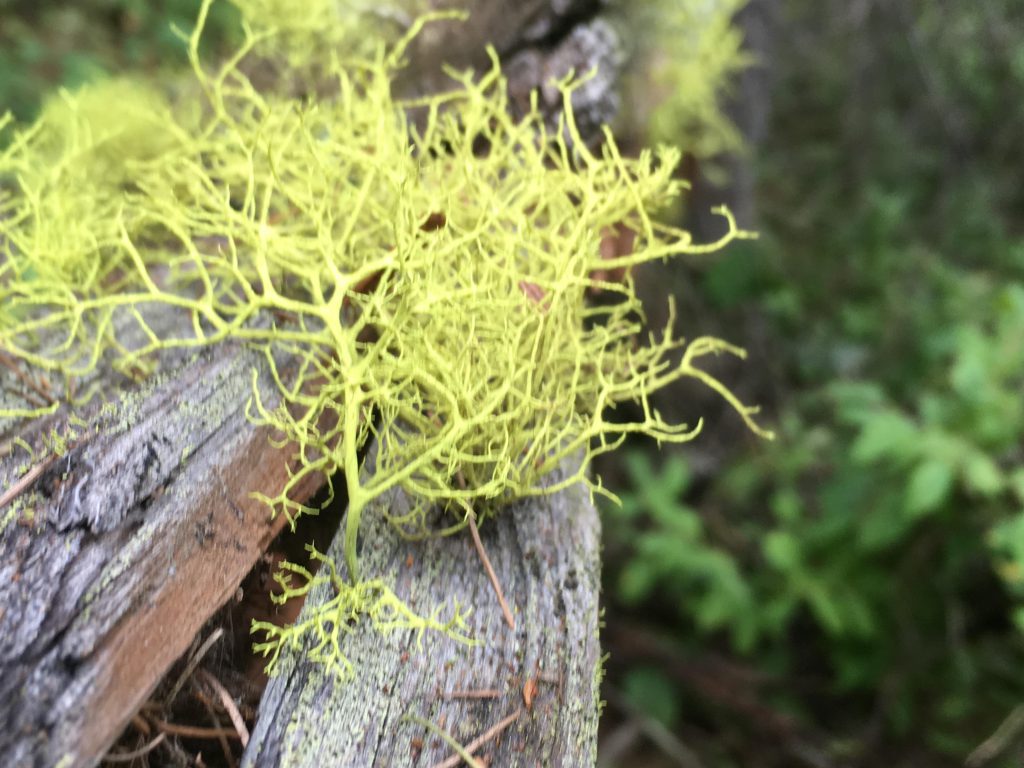
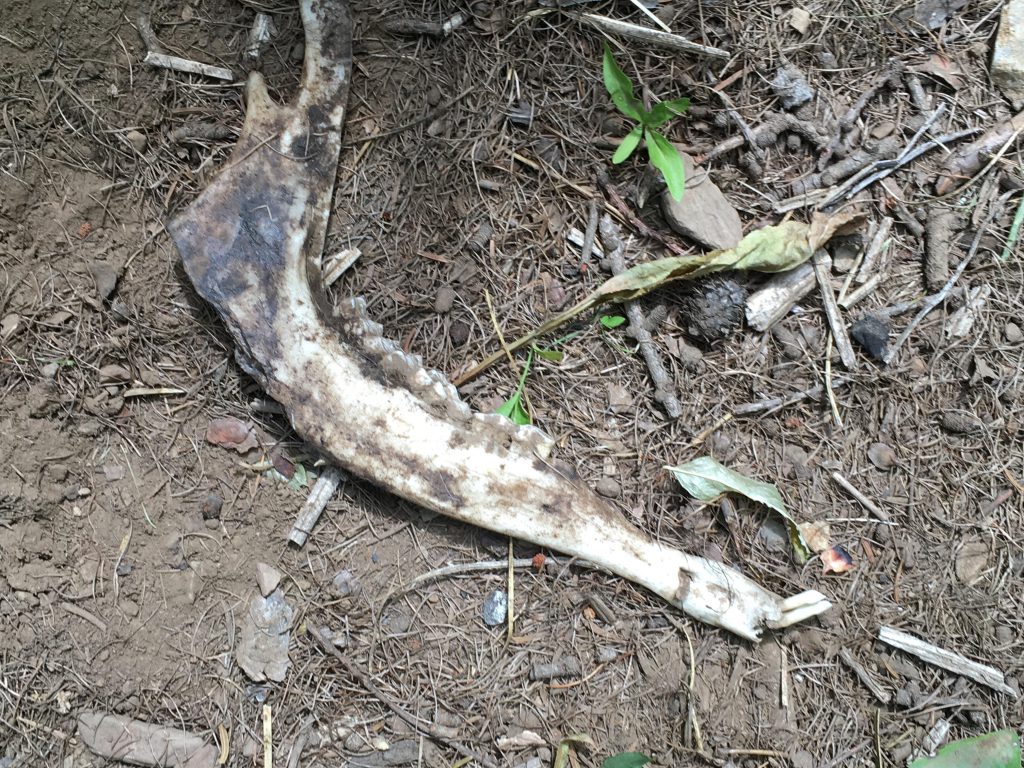
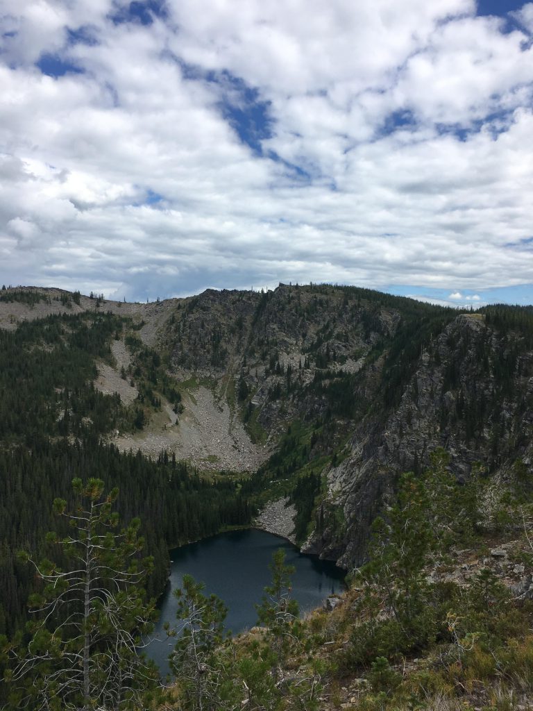
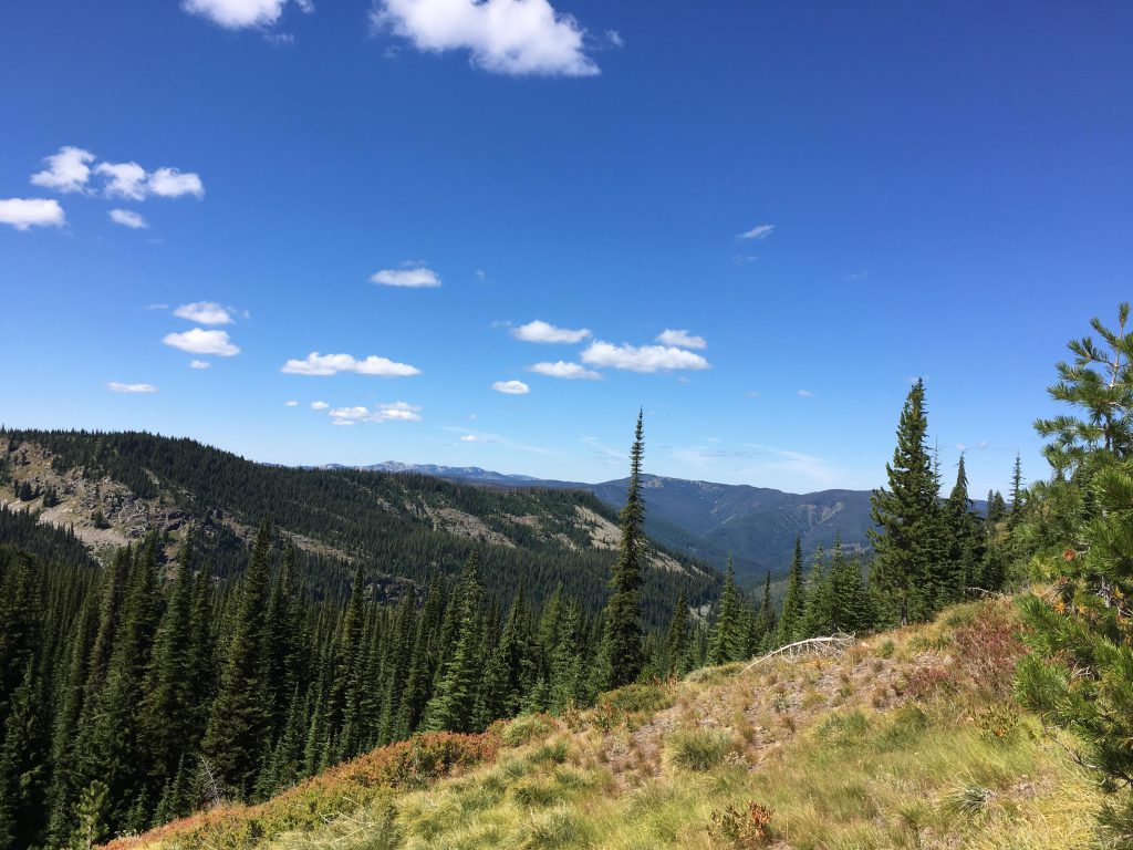
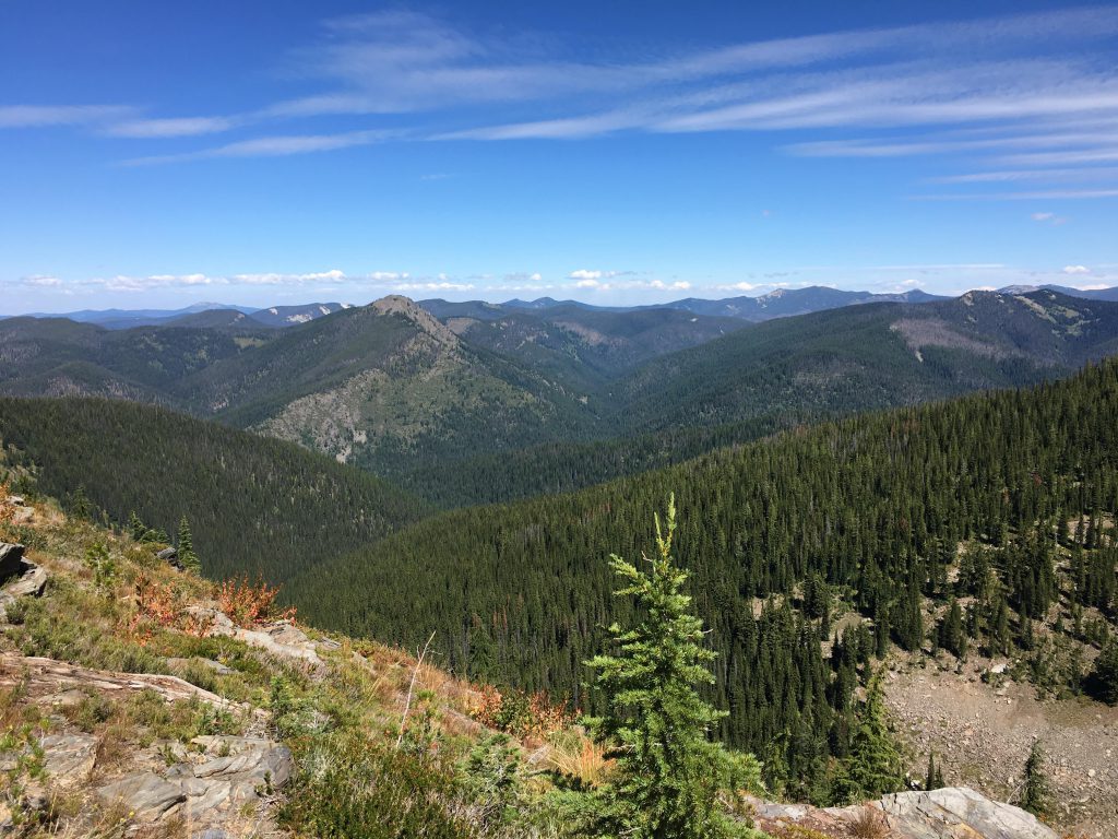
The next day brought us to the first fording of the St. Joe. It was icy cold, but this late in the year carried only a couple of feet of water. There was hemming and hawing nonetheless, all from members of the pack that exceeded my shoulder height by an order of magnitude! There were actually two arms of the river to cross, so don’t put your sandals away too soon. Anyway, we all made it safely to the other side and then waived goodbye to the St. Joe as trail #66 led steeply uphill. The Scribe and I took the lead and soon lost sight of the rest of the pack. That was untenable, of course, and I reverted to round up the stragglers who indulged themselves in a huckleberry thicket.The steep ascent–we gained over 2,000 feet within a few miles–didn’t help the situation. I tirelessly moved back-and-forth and back-and-forth and finally managed to herd everyone uphill. The views were gorgeous, and so were the huckleberries. We followed the spine of the ridge for what seemed an eternity (Little Pup’s words). The area recently suffered a forest fire, and deadfall blocked the trail all too frequently. On and on we moved through wide swathes of huckleberry and beargrass, tall meadows of bracken fern, and past lichen-covered logs, where I found the bleached remains of a deer’s jaw bone. The trail bypassed Bacon Peak and brought us to a saddle overlooking Forage Lake. The pack mistakenly took this for our destination and jubilated until the Scribe set the record straight. Bacon Lake was on the right, not the left. We still had a few miles to go.
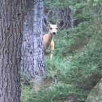
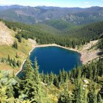
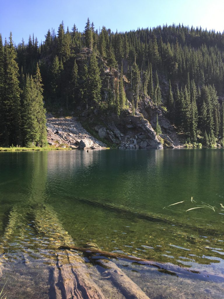
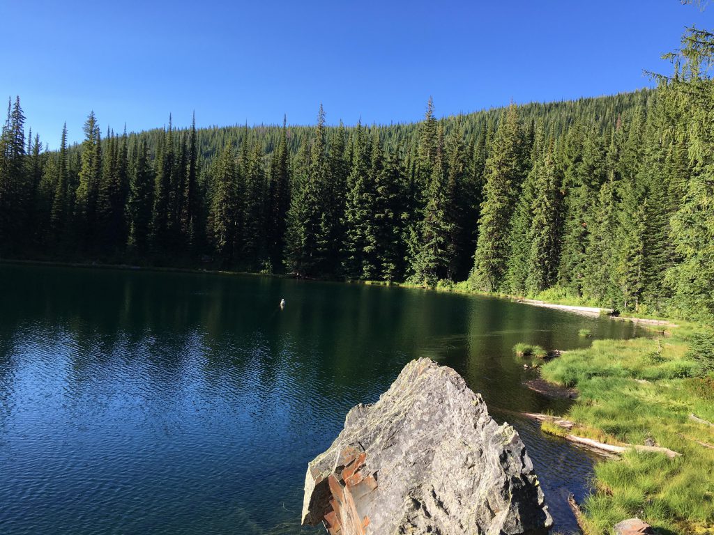
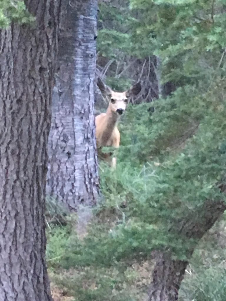
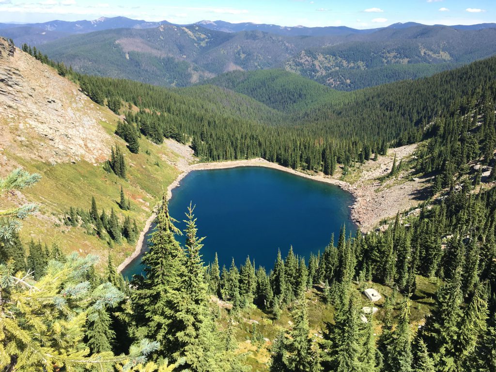
And so onward we moved, soon reaching the fork leading to a steep half-mile downhill to Bacon Lake. And that was totally worth it! A beautiful cirque lake in the middle of nowhere with a convenient campsite right next to it, complete with log seats, rock-slab table and fire ring. What more could we ask for? Actually, a few things come to mind: a double ration of food, fish instead of goo, treats (buffalo jerky, please, please please, please), a triple ration of food. I think I could go on for awhile. Well, the same old mush it was that night, but the company was different. A muledeer came to investigate us, perhaps in hopes of handouts. My warning wuffs went entirely unheeded and the perpetrator came ever closer, snacking, sadly, on toilet paper someone had left unburied in the woods.
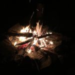
Then it was time for the same old routine: kitchen cleanup, camp setup. Soon we had a nice campfire going, and it was much needed, for the night was even colder at the higher elevation. The muledeer kept on returning, which I answered with deep growling barks that echoed terrifyingly across the mountains for miles and miles and sent the muledeer flying, bouncing on trampoline-like hooves. Then it was off to bed, where I got dressed in pj’s to fight off the cold. Hmmm. Not sure about that.
The sun was hot and bright the next day, which put the notion of a cleansing bath into the Scribe’s head. Nothing wrong with that, but whenever he’s in a lake he wants me to swim way out with him and that’s just not my style. This day was no exception. He nosedived in, snorted and sputtered, and yelled for me to follow. I jumped in after him, paddled my dutiful turn, clambered out, and promptly got called back. I did another halfhearted turn, withdrew, and ignored the Scribe’s pleas. I should note that the Lady also took a bath, without insisting on my presence, but neither of the pups did. Since I’m presumably at the very bottom of the hierarchy, I think I shouldn’t have had to either….
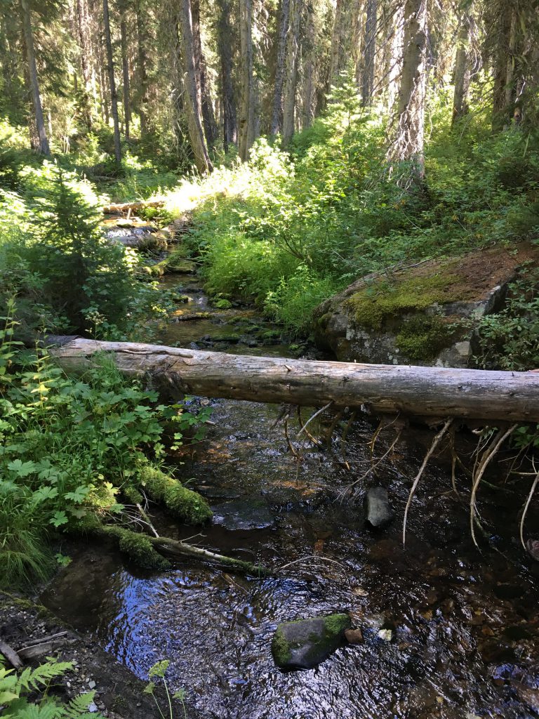
Then it was back up to the ridge and eastwards to a spot overlooking Halo Lake far below and the St. Joe river valley beyond. This was the highest point of the hike and we dropped over the far side where sweeping switchbacks led through open meadows and thin forest down to Tinear Creek. Here we got a choice of stepping stones and a log for the crossing. The Scribe crossed on the log, I waded right through the water, and the rest tiptoed over the stones. Beyond, the path widened into an overgrown logging road and paralleled the meandering creek.
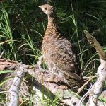
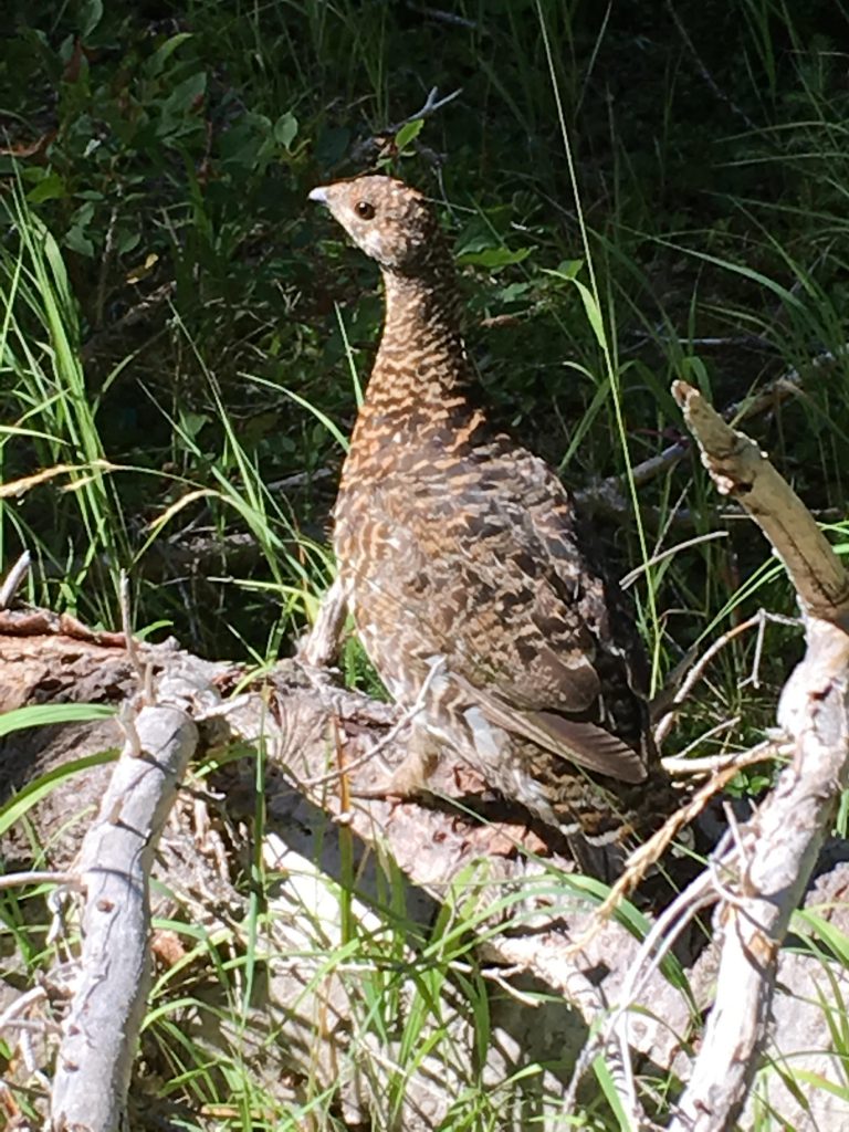
The trail was pleasant and shaded; in fact, in would have been perfect had it not been for the trees we had to climb or circumvent all too often. Doing so, we came upon a family of grouse, which remained still and smiling for the picture-taking.
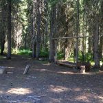
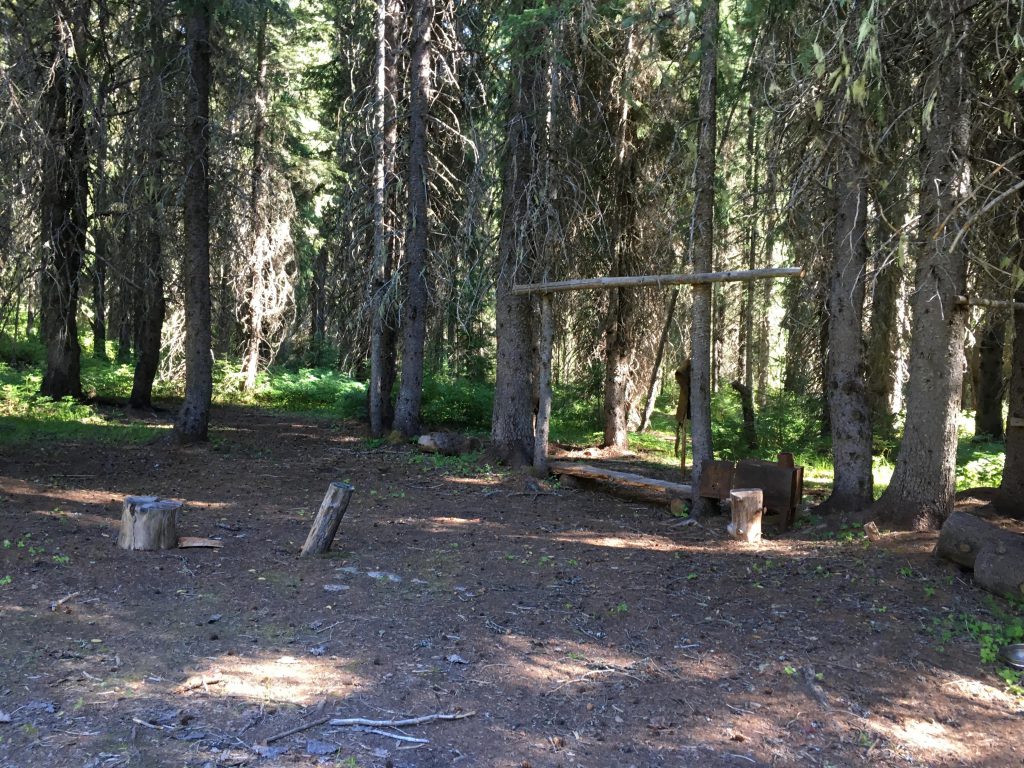
After that, a number of creeks had to be crossed, among them Mill Creek, Bean Creek, and the North Fork of the Bean. None were tremendously difficult, but resulted in wet boots nonetheless. Shortly after crossing the North Fork of the Bean the trail opened up on a wide meadow and an exceedingly pleasant camping spot, called Mule Camp. Aside from equestrian lodgings, it featured an elaborate fire ring and a set of high-backed chairs sawed from logs. Unfortunately, the Scribe insisted that based on his literature we needed to cross Bean Creek at this point. This was obviously nonsense, but it is futile to point out such things, and so we stumbled around in the woods and bogs for a bit. There were many interesting smells, and thus I led the pack further and further down the primrose path. Actually, it was a mere game trail, if that. But even I got tired after awhile and so we backtracked to Mule Camp, moved in a northwesterly direction to the cairn in the middle of the meadow, then continued along the same trajectory to a gap in the woods. Sure enough there was a trail blaze on the first sizable tree, and a wooden bridge followed immediately after. We were back on track.
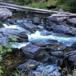
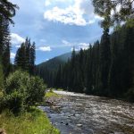
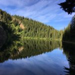
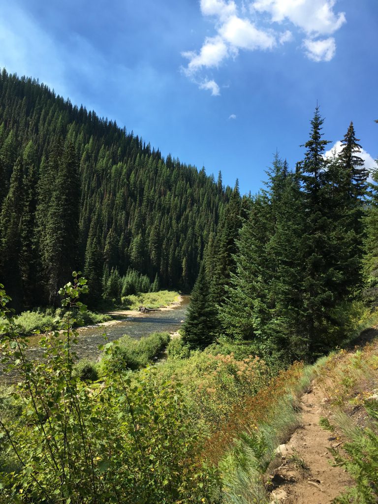
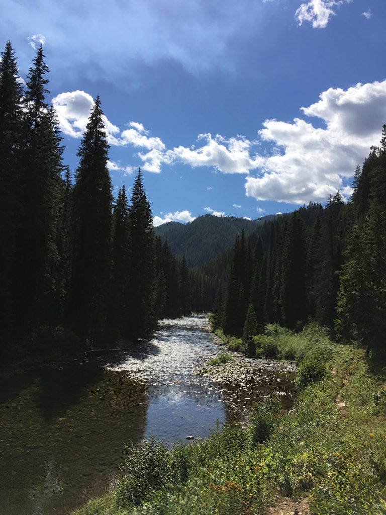
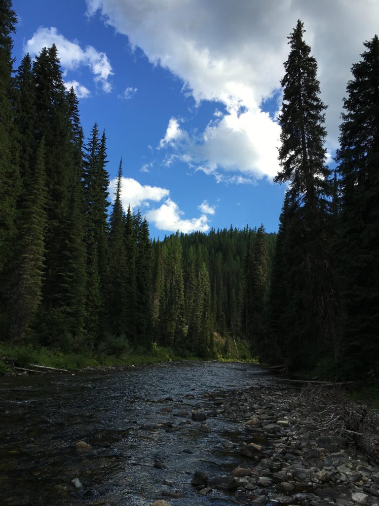
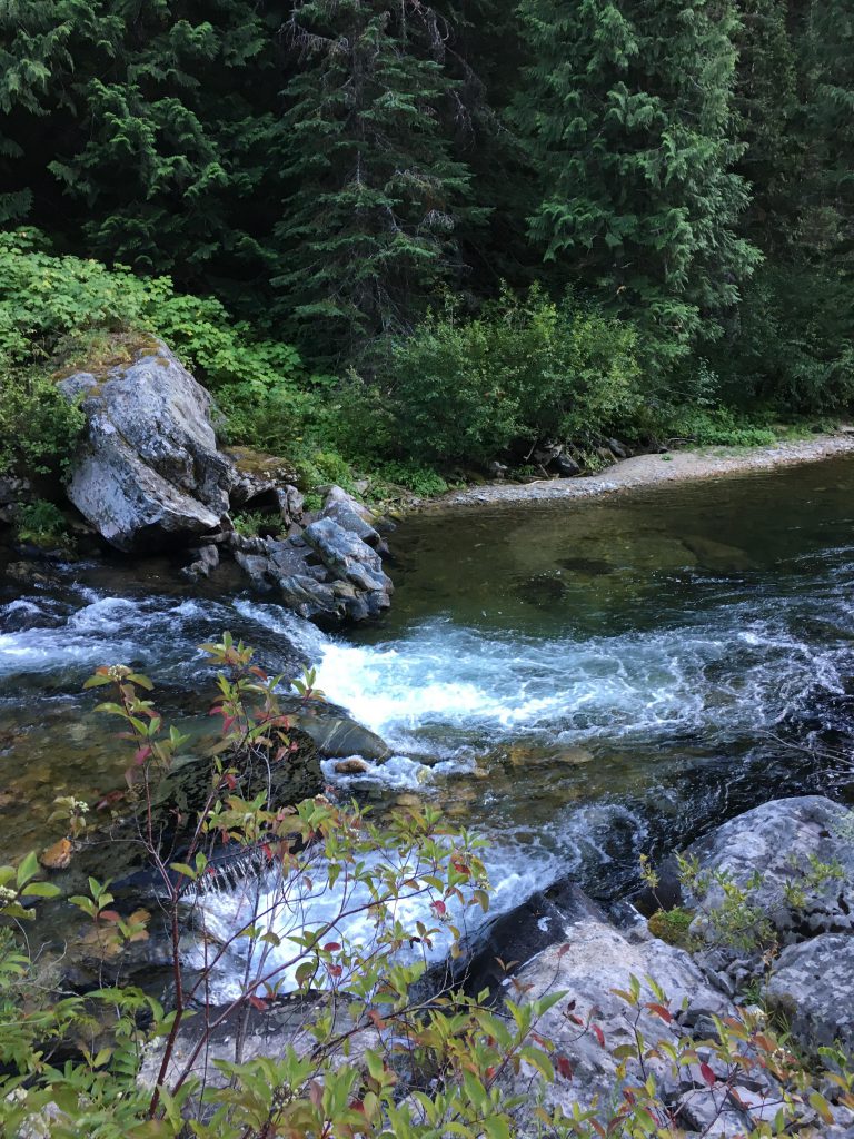
We remained on the north side of Bean Creek until we got close to Dump Creek, which drains Halo Lake on the far side of Bean Creek. We crossed Bean Creek on a giant log, only to return by similar conveyance a short distance downstream. After that we stayed on the north side of Bean Creek up to its confluence with the St. Joe river. The fording there was straightforward and we found an okay campsite right afterwards, good enough for a stop and refill of our water bottles. Back on the St. Joe River Trail #48, the going improved with no more logs to climb and only one major tributary to cross. The St. Joe, meanwhile, gurgled and bubbled pleasantly to our left, a bit untidier upstream and dotted with rapids, narrows, waterfalls, and inviting pools.
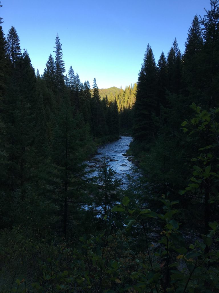
Evening approached as we got closer to our destination for the day: Broken Leg Creek. The Scribe dismissed a campsite near the river that required a bit of bushwacking to get to. This “planning,” as most of his strategizing, backfired when we got to the Broken Leg campsite. It was beautiful and right on the river and spacious and everything you could ask for. And it was taken! Bummer. Everyone was bushed because it had been a long day (except for me, honestly I could have gone another 50 -100 miles, give or take). The campers were more than willing to share the site, but the Scribe decided to move on and so we staggered into the outfitter’s camp on Broken Leg Creek, just as the last rays of sunlight slipped behind the tall fir trees. The site was okay, not great, and we quickly set up camp, ate by the light of our headlamps, skipped the campfire altogether and went to bed.
We also skipped breakfast the next day and continued along the St. Joe. After a bit over a mile we arrived back at the first fording of the St. Joe and from there it was only a short hop to our very first campsite, which was even prettier now. We spent a full hour on an elaborate breakfast, but I’m really speaking for the pack; <em>my</em> breakfast was prepped and consumed in less than 10 seconds. For the next 8 miles we retraced our steps on trail #48 to the car.
Alternate Routes
- To make this a complete loop, take trail #230 up Broken Leg Creek, then #79 North until it meets up with #279. Take 279 down to the St. Joe. You will come out onto FH50/St. Joe River Road about a mile north of Spruce Tree Campground.
Things to Consider
- Had some issues with the GPS recording. A few sections are missing, for example the descent to Bacon Lake and a short distance along the St. Joe river.
Not so great
I don’t fish, but I saw them jump. The lakes are being stocked.
Did you have to backtrack from Bacon Lake to the St. Joe river and then on to Tinear Creek. Or, did you continue past Bacon Lake and connect to Tinear Creek up stream of the St. Joe river?
Marty, you don’t have to backtrack to the St. Joe. The Bacon trail (#66) follows the Bacon Ridge for the most part (or slightly below the ridge), and this is high up above the St. Joe at around around 6,000 feet. Somewhere between Forage and Halo Lakes the trail forks and a spur leads downhill half a mile into the Bacon Lake bowl. In fact, if you want to skip Bacon Lake you just take the other branch of the fork and continue along the ridge to the Bacon/Bean divide above Halo Lake (I’m assuming you’re going counterclockwise as we did) and then drop down to Tinear. Bacon Lake is definitely worth a visit, though. You could probably bushwhack to Halo Lake or Forage Lake, too, but Bacon Lake has an established trail and the spur is just about half a mile, which is the only stretch you’ll be backtracking. Definitely one of my favorite hikes!
Thank you Naughty. I assumed there was a trail on the ridge connecting to Linear Creek. However, the GAIA gps map track doesn’t show it. Bacon Lake looks wonderful. Any fish in that lake?